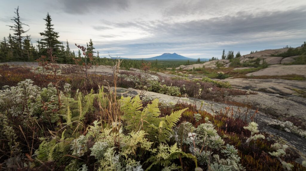
The Canadian Shield is a vast geological formation consisting of ancient Precambrian rock that covers nearly half of Canada’s land surface, extending into parts of the northern United States. This horseshoe-shaped region spans approximately 8 million square kilometers and represents some of Earth’s oldest exposed rock, dating back over 4 billion years. The Canadian Shield serves as the geological foundation of North America, containing rich mineral deposits and shaping the continent’s landscape through its exposed bedrock, countless lakes, and low-relief terrain that has been sculpted by billions of years of geological processes.
Understanding the Canadian Shield in Geography
The Canadian Shield, also known as the Laurentian Plateau, represents the ancient geological core of the North American continent. This massive igneous and metamorphic rock formation stretches from Labrador in the east to the Arctic territories in the north, extending westward to Alberta and southward into the northern United States, including parts of Minnesota, Wisconsin, Michigan, and New York’s Adirondack Mountains. The region encompasses roughly 4.6 million square kilometers in Canada alone, making it one of the world’s largest continental shields.
Geographically, the Canadian Shield is characterized by its relatively flat to gently rolling terrain, extensive forests, thousands of lakes and rivers, and exposed bedrock surfaces. The landscape reflects billions of years of erosion that have worn down ancient mountain ranges, leaving behind a low-relief peneplain with elevations typically ranging from 100 to 500 meters above sea level, though some areas reach up to 1,500 meters in Labrador and Baffin Island.
What the Canadian Shield is Made Of
The Canadian Shield consists primarily of Precambrian igneous and high-grade metamorphic rocks that formed between 4.28 billion and 540 million years ago. The dominant rock types include granite, gneiss, and greenstone, which comprise the ancient continental crust. These rocks represent the roots of ancient mountain ranges that have been exposed through billions of years of erosion, revealing the deep crystalline basement that underlies much of North America.
The shield contains some of Earth’s oldest known rocks, with samples from the Acasta Gneiss in the Northwest Territories dating to approximately 4.03 billion years, and minerals from the Nuvvuagittuq Greenstone Belt in Quebec potentially reaching 4.28 billion years old. The region also features extensive mineral deposits including gold, silver, copper, nickel, iron ore, uranium, and diamonds, making it one of the world’s most important mining regions. As of 2026, the Canadian Shield continues to produce over 60% of Canada’s mineral output, contributing significantly to both Canadian and global mineral supplies.
How the Canadian Shield Was Formed
The formation of the Canadian Shield began during the Archean Eon, over 3.5 billion years ago, through a complex process of volcanic activity, tectonic plate movements, and mountain-building events called orogenies. Ancient volcanic islands and oceanic crust collided and fused together through plate tectonic processes, gradually building the continental core. Successive periods of mountain building added new material to the growing craton, while intense heat and pressure metamorphosed the original rocks into the gneisses and schists visible today.
Between 2.5 billion and 1.8 billion years ago, several major orogenic events assembled the various blocks and terranes that now form the Canadian Shield. The Kenoran, Hudsonian, and Grenville orogenies were particularly significant in shaping the shield’s structure. Following these mountain-building episodes, billions of years of weathering and erosion gradually removed the overlying rock, exposing the deep crystalline basement rocks we see at the surface today.
The most recent major influence on the Canadian Shield’s landscape came from glaciation during the Pleistocene Epoch. Massive continental ice sheets, some over 3 kilometers thick, advanced and retreated across the region multiple times over the past 2.6 million years. These glaciers scoured the bedrock, creating the characteristic smooth, rounded surfaces, striations, and the countless lakes and wetlands that define the shield’s modern appearance. The last ice sheet retreated approximately 10,000 years ago, leaving behind the landscape Americans see when visiting northern regions today.
Why It’s Called the Canadian Shield
The term “Canadian Shield” derives from the geological concept of a continental shield, which refers to a large area of exposed Precambrian crystalline rock that forms the stable interior of a continent. The word “shield” in geological terminology describes these ancient, stable blocks of continental crust that have resisted significant deformation for billions of years, acting as a protective foundation for the continent, much like a warrior’s shield provides protection.
The name specifically includes “Canadian” because the vast majority of this geological formation lies within Canada’s borders, even though portions extend into the northern United States. Alternative names include the Laurentian Plateau, named after the Laurentian Mountains in Quebec, and the Precambrian Shield, referencing the age of its rocks. The term gained widespread use in North American geological literature during the early 20th century as scientists mapped and studied this distinctive region, recognizing it as a fundamental geological province that shaped the continent’s development.
Is the Canadian Shield a Plateau
The Canadian Shield is technically classified as both a shield and a plateau, though these terms describe different aspects of the region. As a geological shield, it represents an exposed section of ancient continental crust. As a physiographic region, much of it functions as a plateau called the Laurentian Plateau, featuring relatively flat to gently rolling terrain elevated above surrounding lowlands.
However, the Canadian Shield’s topography varies considerably across its vast extent. While some areas exhibit classic plateau characteristics with flat uplands, other sections display more complex terrain including hills, valleys, and upland areas that rise significantly above the general elevation. The region lacks the dramatic elevation changes and steep escarpments typically associated with many plateaus, instead presenting a landscape of gentle relief created by billions of years of erosion that have leveled ancient mountain ranges into the relatively flat surface observed today.
Why the Canadian Shield is Important
The Canadian Shield holds immense economic importance for both Canada and the United States due to its exceptional mineral wealth. As of 2026, the region produces significant quantities of gold, nickel, copper, zinc, uranium, and diamonds, with Canadian mines supplying critical minerals to American manufacturing and technology industries. The shield contains an estimated $26 trillion worth of untapped mineral resources, making it one of Earth’s most valuable geological formations for resource extraction.
Beyond minerals, the Canadian Shield provides crucial ecological services. Its vast boreal forests store massive amounts of carbon, helping regulate global climate patterns. The region’s countless lakes and rivers form the headwaters for major North American river systems, supplying fresh water to millions of people in both Canada and the United States. The shield’s hydroelectric potential has been extensively developed, with major facilities in Quebec, Ontario, and Manitoba generating clean, renewable electricity that powers both Canadian provinces and is exported to American markets.
Scientifically, the Canadian Shield offers unparalleled opportunities to study Earth’s early geological history. The exposed ancient rocks provide direct access to Precambrian geology, allowing researchers to investigate the planet’s formation, early atmosphere development, and the evolution of life. In 2026, ongoing research on shield rocks continues to yield discoveries about plate tectonics, mineral formation processes, and Earth’s thermal evolution, contributing valuable insights to geological sciences worldwide.
Major Cities in the Canadian Shield Region
While the Canadian Shield is largely characterized by wilderness and sparse population, several significant cities have developed within or along its margins, primarily due to mining activities and resource extraction. Sudbury, Ontario, with a metropolitan population exceeding 165,000 as of 2026, stands as one of the shield’s largest cities, built upon one of the world’s richest nickel deposits. The city developed around mining operations that began in the 1880s and continues as a major mining center today.
Other notable Canadian Shield cities include Thunder Bay, Ontario (population approximately 122,000), which serves as a major transportation hub and port on Lake Superior; Sault Ste. Marie, Ontario and Michigan (combined populations around 95,000), positioned at the strategic junction between Lake Superior and Lake Huron; and Val-d’Or and Rouyn-Noranda in Quebec, both important mining communities in the Abitibi region. Additionally, portions of larger metropolitan areas like Quebec City and the northern suburbs of Montreal touch the shield’s southern edge.
In the United States, while fewer major cities lie directly on Canadian Shield geology, Duluth, Minnesota (population approximately 290,000 in the metro area as of 2026) represents the largest American city situated on shield rocks. Smaller communities throughout northern Minnesota, Wisconsin, and Michigan’s Upper Peninsula, such as Marquette and Houghton, also sit on shield formations and developed historically around mining and forestry industries that exploited the region’s natural resources.
Is the Canadian Shield Habitable
The Canadian Shield is indeed habitable, though its harsh climate, poor soil quality, and rugged terrain have limited dense settlement throughout most of the region. The shield supports a resident population of approximately 10 million people as of 2026, primarily concentrated in cities and towns along the southern margins and in mining communities scattered throughout the interior. Indigenous peoples have inhabited shield lands for over 10,000 years, developing sophisticated adaptations to the challenging environment.
The primary habitability challenges include extremely cold winters with temperatures regularly dropping below -40°C in northern areas, thin acidic soils unsuitable for agriculture, abundant rock outcrops that complicate construction, and vast distances between settlements. The short growing season, typically 60-120 days depending on latitude, prevents most conventional farming, though some hardy crops and livestock operations exist in southern shield regions. The abundance of black flies and mosquitoes during summer months presents additional challenges for residents and visitors.
Despite these obstacles, modern Canadian Shield communities thrive through resource extraction, hydroelectric development, forestry, tourism, and increasingly, remote work opportunities enabled by improved internet connectivity as of 2026. Towns and cities provide full amenities including healthcare, education, and cultural facilities. The region’s natural beauty, outdoor recreational opportunities, and relatively affordable housing compared to southern Canadian and American cities have attracted new residents in recent years, particularly to southern shield communities within commuting distance of larger urban centers like Ottawa, Montreal, and Thunder Bay.
Is the Canadian Shield the Oldest Rock in the World
The Canadian Shield contains some of the oldest known rocks on Earth, though not exclusively the absolute oldest. The Acasta Gneiss, located near Great Slave Lake in the Northwest Territories, has been radiometrically dated to approximately 4.03 billion years old, making it among the oldest intact rock formations ever discovered. Even older mineral grains have been found within shield rocks, with zircon crystals from the Nuvvuagittuq Greenstone Belt in northern Quebec potentially dating to 4.28 billion years ago.
However, other regions globally also contain extremely ancient rocks of comparable age. Jack Hills in Western Australia has yielded zircon crystals dated to 4.4 billion years, currently the oldest known terrestrial material. The Barberton Greenstone Belt in South Africa and the Pilbara Craton in Australia both contain rocks approximately 3.5 billion years old. What makes the Canadian Shield exceptional is not solely the age of individual rocks, but the vast extent of exposed Precambrian crust, providing an unparalleled surface area of ancient geology accessible for scientific study.
The shield’s ancient rocks continue to yield critical information about Earth’s early history. Studies published in 2025 and 2026 have used shield samples to investigate the planet’s early magnetic field, atmosphere composition, and the conditions that allowed life to emerge. The combination of age, accessibility, and geological diversity makes the Canadian Shield an invaluable natural laboratory for understanding our planet’s first 4 billion years, even if it shares the distinction of “world’s oldest rocks” with select formations on other continents.
The Canadian Shield on Maps
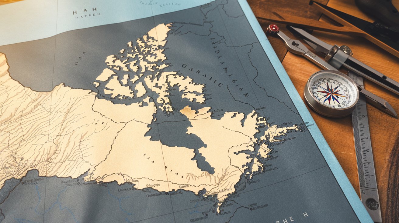
On maps, the Canadian Shield appears as a massive horseshoe or arc-shaped region that wraps around Hudson Bay, extending from Labrador on the Atlantic coast westward through Quebec and Ontario, northward through Nunavut and the Northwest Territories, and curving southwest through northern Saskatchewan, Alberta, and into the northern United States. Geological maps typically depict the shield in distinctive colors, often pink, purple, or brown tones, to differentiate the Precambrian basement rocks from surrounding younger geological provinces.
Modern topographic and satellite maps reveal the shield’s characteristic features: countless lakes appearing as blue patches scattered across the landscape, extensive boreal forests shown in green, and exposed bedrock areas visible in gray or bare earth tones, particularly in northern regions above the treeline. The shield’s boundaries are generally drawn where Precambrian rocks disappear beneath younger sedimentary cover, creating a distinct geological boundary visible on both physical and geological maps.
For American audiences, maps show the shield extending southward into the United States through northeastern Minnesota’s Arrowhead region, northern Wisconsin, Michigan’s Upper Peninsula, and the Adirondack Mountains of New York. These areas represent the shield’s southern extent, where ancient Precambrian rocks either outcrop at the surface or lie beneath relatively thin sedimentary cover. Interactive digital maps available in 2026 allow users to explore the shield’s geology, mineral deposits, ecological zones, and human settlements with unprecedented detail, making this ancient geological feature accessible to students, researchers, and the general public.
Natural Resources and Economic Impact
The Canadian Shield’s mineral wealth has fundamentally shaped North American economic development since the late 19th century. As of 2026, the region produces over 90% of Canada’s metal ores, including world-leading quantities of nickel from Sudbury, gold from the Abitibi region and Red Lake district, and uranium from Saskatchewan’s Athabasca Basin. The shield also contains major diamond deposits in the Northwest Territories, with mines such as Diavik and Ekati contributing significantly to global diamond supply since their discovery in the 1990s.
The hydroelectric potential of shield rivers has been extensively developed, with installed capacity exceeding 75,000 megawatts across Quebec, Ontario, Manitoba, and Labrador as of 2026. Massive facilities like the James Bay Project and Churchill Falls generate electricity that powers both Canadian provinces and exports to American states including New York, Vermont, and the New England region. This clean, renewable energy provides economic benefits estimated at over $5 billion annually while reducing carbon emissions compared to fossil fuel alternatives.
Forestry represents another major economic activity on the Canadian Shield, with the boreal forest covering approximately 3 million square kilometers of the region. Sustainable timber harvesting, pulp and paper production, and increasingly, wood pellet manufacturing for renewable energy support tens of thousands of jobs. The forestry sector generates approximately $18 billion in annual economic activity as of 2026, supplying both Canadian and American markets with lumber, paper products, and biomass energy materials from this vast renewable resource.
Climate and Environmental Conditions
The Canadian Shield experiences predominantly continental subarctic and humid continental climates, characterized by long, extremely cold winters and short, mild to warm summers. Winter temperatures routinely drop below -30°C across much of the region, with some northern areas experiencing average January temperatures of -40°C or colder. Summer temperatures typically range from 15°C to 25°C in July, providing a brief but intense growing season for the boreal ecosystem that dominates the landscape.
Precipitation across the shield varies considerably, ranging from 300 millimeters annually in the driest northern areas to over 1,000 millimeters in southeastern regions near the Atlantic coast and Great Lakes. Most precipitation falls as snow, with many areas receiving 200-400 centimeters of snowfall annually, creating deep snowpack that persists from October through April or May. The region’s countless lakes freeze solid during winter, with ice thickness reaching 1-2 meters, while spring snowmelt drives dramatic seasonal water level fluctuations in rivers and wetlands.
The environmental conditions on the shield have created one of Earth’s largest intact forest ecosystems, with black spruce, white spruce, jack pine, and balsam fir dominating the boreal forest. The region supports diverse wildlife including moose, caribou, black bears, wolves, and millions of waterfowl that nest in the shield’s wetlands during summer. As of 2026, climate change is measurably affecting the shield, with temperatures rising approximately 2-3°C over the past century, altering permafrost distribution, forest composition, and wildlife ranges, particularly in northern areas where changes are most pronounced.
Related video about what is the canadian shield
This video complements the article information with a practical visual demonstration.
Questions & Answers
Is the Canadian Shield habitable for permanent residence?
Yes, the Canadian Shield is habitable and supports approximately 10 million permanent residents as of 2026. While the harsh climate, thin soils, and rugged terrain present challenges, numerous cities and towns thrive throughout the region, particularly in mining centers like Sudbury and Thunder Bay. Indigenous peoples have lived successfully on shield lands for over 10,000 years. Modern communities offer complete amenities including healthcare, education, and employment opportunities, primarily in resource extraction, forestry, hydroelectric operations, and increasingly, remote work sectors enabled by improved internet connectivity.
What makes the Canadian Shield geologically unique?
The Canadian Shield is unique as one of Earth’s largest exposed sections of Precambrian continental crust, with rocks dating back 4.28 billion years. It contains some of the planet’s oldest known geological formations, including the Acasta Gneiss at 4.03 billion years old. The shield’s exceptional exposure of ancient crystalline basement rocks provides unparalleled opportunities to study early Earth processes, plate tectonics, and mineral formation. Its vast extent of 8 million square kilometers makes it the largest area of exposed Precambrian rock globally, offering scientists direct access to geological history spanning most of Earth’s existence.
How does the Canadian Shield affect the United States?
The Canadian Shield extends into the northern United States, affecting Minnesota, Wisconsin, Michigan, and New York’s Adirondack Mountains with exposed Precambrian bedrock. It supplies critical minerals including iron ore, copper, and nickel to American industries. The shield’s hydroelectric facilities export significant electricity to northeastern states, providing clean energy to millions of American consumers. Shield geology influences regional topography, soil composition, and water resources in border states. As of 2026, approximately $12 billion in annual trade between the U.S. and Canada involves resources directly extracted from shield lands, making it economically significant to American manufacturing and energy sectors.
Why is the Canadian Shield important for mineral resources?
The Canadian Shield is exceptionally important for mineral resources because its ancient Precambrian rocks underwent billions of years of geological processes that concentrated valuable metals. The region produces over 60% of Canada’s mineral output as of 2026, including world-leading quantities of nickel, gold, uranium, copper, and diamonds. The exposed bedrock makes mineral exploration and extraction more accessible compared to regions where valuable deposits lie beneath thick sedimentary cover. With an estimated $26 trillion in untapped mineral resources, the shield represents one of Earth’s most valuable geological provinces, supplying critical materials for technology, construction, and manufacturing industries across North America.
What cities are located in the Canadian Shield?
Major Canadian Shield cities include Sudbury, Ontario (population over 165,000), Thunder Bay, Ontario (approximately 122,000), and Sault Ste. Marie spanning Ontario and Michigan. In Quebec, Val-d’Or and Rouyn-Noranda serve as important mining centers. The largest American city on shield geology is Duluth, Minnesota, with a metropolitan population around 290,000 as of 2026. Smaller communities include Marquette and Houghton in Michigan’s Upper Peninsula. Most shield cities developed around mining operations, strategic transportation locations, or hydroelectric facilities. While population density remains low compared to southern regions, these communities provide full urban amenities and economic opportunities primarily in resource extraction and processing industries.
How was the Canadian Shield formed over billions of years?
The Canadian Shield formed through complex geological processes beginning over 3.5 billion years ago during the Archean Eon. Ancient volcanic islands and oceanic crust collided through plate tectonics, gradually building the continental core. Major mountain-building events called orogenies, including the Kenoran, Hudsonian, and Grenville events between 2.5 and 1 billion years ago, added material and metamorphosed rocks under intense heat and pressure. Billions of years of erosion subsequently removed overlying mountains, exposing the deep crystalline basement rocks visible today. The most recent modification came from Pleistocene glaciation, with massive ice sheets sculpting the landscape and creating the countless lakes and smooth bedrock surfaces that characterize the shield in 2026.
| Key Aspect | Important Details | Significance |
|---|---|---|
| Geographic Extent | 8 million km² covering half of Canada, extending into northern U.S. states | One of world’s largest exposed Precambrian rock formations |
| Age | 4.28 to 0.54 billion years old, with Acasta Gneiss at 4.03 billion years | Contains some of Earth’s oldest known rocks and minerals |
| Rock Composition | Primarily granite, gneiss, and greenstone; igneous and metamorphic rocks | Represents ancient continental crust and mountain roots |
| Mineral Resources | Gold, nickel, copper, uranium, diamonds; 60% of Canada’s mineral output (2026) | $26 trillion estimated untapped resources; critical to North American economy |
| Hydroelectric Power | 75,000+ megawatts installed capacity across multiple provinces | Supplies clean energy to Canada and exports to U.S. northeastern states |
| Population | ~10 million residents in cities, towns, and Indigenous communities | Habitable despite harsh climate; supports resource-based economies |
| Climate | Continental subarctic; winters to -40°C, summers 15-25°C | Supports vast boreal forest ecosystem; experiencing climate change effects |
| U.S. Connection | Extends into Minnesota, Wisconsin, Michigan, and New York | Provides minerals and hydroelectric power; shared geological heritage |