The Canadian Shield landmarks represent some of North America’s most ancient and spectacular geological features, with rock formations dating back over 4 billion years. This vast region stretches across nearly half of Canada, encompassing stunning natural attractions from dramatic waterfalls to pristine lakes and towering cliffs. For travelers from the United States seeking unique natural wonders, the Canadian Shield offers unparalleled opportunities to witness Earth’s geological history firsthand.
What is the Canadian Shield Famous For
The Canadian Shield is famous for being one of Earth’s oldest geological formations, containing rocks that formed during the Precambrian era over 2.5 billion years ago. This massive shield landmark covers approximately 1.8 million square miles across Canada and extends into the northern United States, including parts of Minnesota, Wisconsin, Michigan, and New York. The region is renowned for its exposed bedrock, ancient granite formations, and thousands of lakes carved by glacial activity during the last ice age.
Beyond its geological significance, the Canadian Shield is famous for its vast mineral wealth, containing substantial deposits of gold, silver, copper, nickel, and uranium. The region supports unique boreal ecosystems with diverse wildlife populations and provides critical watershed protection for North America. As of 2026, conservation efforts have intensified to protect over 250,000 square miles of pristine Canadian Shield habitat, making it increasingly attractive to eco-tourists from the United States and worldwide.
Major Landforms in the Canadian Shield
The major landforms in the Canadian Shield reflect billions of years of geological processes, creating distinctive features that distinguish this region from other North American landscapes. Understanding these formations helps visitors appreciate the dramatic scenery and unique characteristics of Canadian Shield landmarks.
Ancient Rock Formations and Exposed Bedrock
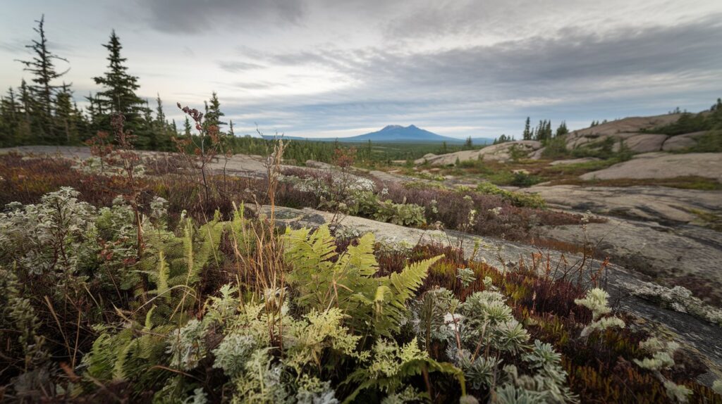
The exposed bedrock of the Canadian Shield consists primarily of igneous and metamorphic rocks, including granite, gneiss, and greenstone belts. These formations represent the roots of ancient mountain ranges that eroded over billions of years, leaving behind a relatively flat but rugged landscape. Visitors can observe spectacular rock formations at locations like the Precambrian outcrops along Lake Superior’s north shore, where billion-year-old granite cliffs rise directly from the water. The colorful mineral deposits visible in these rocks tell the story of Earth’s early volcanic activity and tectonic movements.
Glacially-Carved Lakes and Waterways
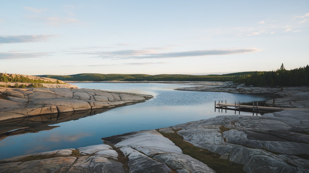
The Canadian Shield landscape features over two million lakes carved by massive glaciers during the Pleistocene epoch. These water bodies range from tiny kettle lakes to massive bodies like Great Bear Lake and Great Slave Lake, which rank among North America’s largest. The interconnected waterways of the Canadian Shield create exceptional opportunities for canoeing and kayaking, with routes like the historic fur trade passages still navigable today. Glacial striations visible on rock surfaces throughout the region demonstrate the immense power of ice sheets that once covered this entire area.
Top 10 Famous Canadian Shield Landmarks
Identifying the most spectacular Canadian Shield landmarks helps travelers prioritize their visits to this vast region. These famous landmarks showcase the geological diversity and natural beauty that make the Shield a world-class destination.
Niagara Escarpment and Bruce Peninsula
The Niagara Escarpment represents the southern edge of the Canadian Shield, stretching over 450 miles from New York through Ontario to Wisconsin. This UNESCO World Biosphere Reserve features dramatic limestone cliffs, ancient cedar forests, and crystal-clear waters. The Bruce Peninsula showcases spectacular shoreline formations including the famous Grotto sea cave and Flowerpot Island, where erosion has created towering rock pillars. As of 2026, the Bruce Trail offers 550 miles of maintained hiking routes, making these Shield landmarks easily accessible to visitors from the United States.
Algonquin Provincial Park Highlands
Algonquin Provincial Park encompasses 2,955 square miles of pristine Canadian Shield wilderness, featuring rolling hills, maple forests, and over 2,400 lakes. The park’s landmark features include the Barron Canyon, where ancient rock walls rise 330 feet above the Barron River, and the Achray area’s towering white pines. Wildlife enthusiasts can observe moose, black bears, and wolves in their natural habitat. The park receives approximately 800,000 visitors annually, with Americans representing nearly 30% of total visitation in 2026.
Killarney Provincial Park White Quartzite Ridges
The brilliant white quartzite ridges of Killarney Provincial Park create one of the most photographed landscapes in the Canadian Shield. These ancient mountains, part of the La Cloche range, contrast dramatically with the blue waters of Georgian Bay and surrounding evergreen forests. The park inspired Canada’s famous Group of Seven artists, and the landmark scenery continues attracting photographers and outdoor enthusiasts. The 62-mile La Cloche Silhouette Trail ranks among North America’s premier backpacking routes.
Lake Superior Provincial Park Coastal Formations
Lake Superior Provincial Park protects 60 miles of rugged Canadian Shield coastline where ancient granite cliffs meet the world’s largest freshwater lake. Notable landmarks include the Agawa Rock Pictographs, indigenous rock art dating back centuries, and the dramatic coastal formations at Orphan Lake. The park’s interior features pristine boreal forest and over 100 lakes. Visitors can experience the raw power of Lake Superior’s storms against billion-year-old rock at locations like Old Woman Bay.
Thousand Islands and St. Lawrence River Region
The Thousand Islands region contains approximately 1,864 islands formed from Canadian Shield granite along the St. Lawrence River. This landmark area straddles the US-Canada border, with many islands accessible from New York state. The exposed Shield bedrock creates unique ecosystems supporting rare plant species. Boldt Castle and Singer Castle represent human-made landmarks built upon the ancient granite foundations, demonstrating how the Canadian Shield has supported human settlement.
Temagami and Lady Evelyn-Smoothwater Wilderness
The Temagami region preserves some of Ontario’s last remaining old-growth forests atop Canadian Shield bedrock. Landmark features include Maple Mountain’s fire tower offering panoramic Shield views, and Ishpatina Ridge, Ontario’s highest point at 2,274 feet. The Lady Evelyn-Smoothwater Wilderness Park protects pristine Shield landscape with spectacular waterfalls including High Falls, which drops 45 feet over ancient rock formations. The region’s extensive canoe routes total over 1,200 miles of interconnected waterways.
Muskoka Lakes and Granite Outcrops
The Muskoka region features iconic Canadian Shield scenery with smooth granite shores, crystal-clear lakes, and windswept pines. Famous landmarks include the Big Chute Marine Railway, which lifts boats over exposed bedrock, and the rugged coastlines of Lake Muskoka, Lake Rosseau, and Lake Joseph. The region’s distinctive pink granite has been quarried for over a century, contributing to buildings throughout North America. Muskoka’s accessibility makes it a popular destination for US visitors, located just 90 minutes north of Toronto.
Pukaskwa National Park Wilderness Coast
Pukaskwa National Park protects the largest wilderness area on Lake Superior’s northern shore, featuring untouched Canadian Shield coastal landscape. The park’s landmark attractions include the 60-mile Coastal Hiking Trail showcasing dramatic cliff formations, secluded beaches with wave-polished stones, and the mysterious Pukaskwa Pits, ancient rock structures of uncertain origin. This remote park offers visitors authentic wilderness experiences with minimal development, preserving the Shield’s primordial character.
Kakabeka Falls and Kaministiquia River
Kakabeka Falls, known as the Niagara of the North, plunges 131 feet over a Canadian Shield cliff along the Kaministiquia River near Thunder Bay. This spectacular landmark waterfall flows through a deep gorge carved into ancient Precambrian rock, with viewing platforms providing safe access to multiple perspectives. Fossil stromatolites visible in the gorge walls date back 1.6 billion years, representing some of Earth’s earliest life forms. The falls remain accessible year-round, with winter ice formations creating additional natural sculptures.
Ouimet Canyon Provincial Park
Ouimet Canyon represents one of the Canadian Shield’s most dramatic geological features, with sheer cliffs dropping 350 feet into a narrow gorge that stretches nearly two miles. This landmark canyon maintains a unique microclimate at its base, supporting arctic-alpine plants typically found much farther north. The canyon formed through frost-wedging and erosion of diabase sills intruding into ancient Shield rock. Suspended viewing platforms allow visitors to safely observe this natural wonder, with interpretive displays explaining the geological processes involved.
Canadian Shield Tourist Attractions and Activities
The Canadian Shield offers diverse tourist attractions catering to various interests from geological education to outdoor recreation. Understanding available activities helps visitors plan comprehensive trips to experience these ancient landmarks fully.
Outdoor Recreation Opportunities
Outdoor recreation in the Canadian Shield encompasses world-class canoeing, kayaking, hiking, and camping experiences. The region’s interconnected waterways support multi-day paddling expeditions through pristine wilderness, with routes ranging from beginner-friendly day trips to challenging week-long adventures. Rock climbing enthusiasts find excellent granite climbing at locations throughout the Shield, particularly in areas like Bon Echo Provincial Park. Fishing for walleye, northern pike, and lake trout draws anglers from across the United States, with some lakes producing trophy-sized specimens due to cold, clean Shield waters.
Educational and Cultural Experiences
Educational attractions throughout the Canadian Shield help visitors understand the region’s geological and cultural significance. The Science North museum in Sudbury features extensive exhibits on Shield geology and mining history, including underground tours of actual mine sites. Indigenous cultural centers showcase the thousands of years of human history on the Shield, with pictograph sites like Agawa Rock demonstrating the spiritual significance these landmarks held for First Nations peoples. As of 2026, virtual reality experiences at several interpretive centers allow visitors to witness ancient Shield formation through geological time.
Canadian Shield Climate and Best Visiting Times
Understanding the Canadian Shield climate helps visitors plan optimal times to experience these natural landmarks. The region experiences a continental climate with significant seasonal variation, influenced by its northern latitude and distance from moderating ocean influences.
Summer temperatures from June through August average 68-77°F, creating ideal conditions for outdoor activities and Canadian Shield tourism. This peak season offers long daylight hours and accessible trails, though visitors should prepare for occasional thunderstorms. Fall foliage from late September through October transforms the Shield into a spectacular color display, with maple and birch forests providing brilliant reds and golds against ancient granite. Winter temperatures average 5-23°F, creating opportunities for cross-country skiing and snowshoeing, though many remote areas become inaccessible. Spring arrives late, typically in May, with lingering snow in northern sections and higher elevations. The shoulder seasons of May and September offer fewer crowds and comfortable temperatures for hiking, though some facilities may operate on reduced schedules. Climate data from 2026 shows increased variability in precipitation patterns, making flexible planning advisable.
Canadian Shield Animals and Wildlife Viewing
The Canadian Shield animals represent diverse species adapted to the region’s harsh climate and rocky terrain. This boreal ecosystem supports iconic North American wildlife, making the Shield an exceptional destination for nature enthusiasts from the United States.
Large mammals commonly observed include moose, black bears, and white-tailed deer, with populations thriving in the Shield’s protected wilderness areas. Wolves maintain viable populations throughout the region, though they’re rarely seen due to their elusive nature. Smaller mammals like beavers, river otters, and martens play crucial ecological roles, with beaver engineering significantly impacting Shield waterways. The region supports over 200 bird species, including iconic loons whose calls echo across Shield lakes, and several raptor species like bald eagles and ospreys. Boreal owls and Canada jays represent year-round residents adapted to harsh winters. Fish populations include lake trout in deep Shield lakes, walleye in rocky shallows, and brook trout in cold streams. As of 2026, wildlife management programs have successfully maintained healthy populations while accommodating increased tourism. Visitors should observe wildlife from respectful distances and follow proper food storage protocols in bear country.
Planning Your Canadian Shield Landmarks Visit
Successful trips to Canadian Shield landmarks require careful planning regarding access, accommodations, and necessary preparations. These practical considerations ensure safe and enjoyable experiences exploring this vast region.
Access Points and Transportation from the United States
US visitors can access Canadian Shield landmarks through several major entry points along the border. Detroit-Windsor and Buffalo-Niagara Falls crossings provide convenient access to southern Shield regions including the Bruce Peninsula and Niagara Escarpment. Sault Ste. Marie serves as a gateway to Lake Superior’s north shore and central Shield attractions. International Falls and Grand Portage offer access to northwestern Shield areas. Major Canadian cities like Toronto, Ottawa, and Thunder Bay serve as transportation hubs with rental car availability and domestic flight connections. Remote Shield locations may require float planes or extended drives on gravel roads, with some wilderness areas accessible only by canoe. Valid passports are required for all border crossings as of 2026, with enhanced driver’s licenses no longer accepted.
Accommodations and Lodging Options
Accommodation options near Canadian Shield landmarks range from rustic wilderness camping to full-service resorts. Provincial parks throughout the region offer campgrounds with varying amenity levels, from backcountry sites accessible only by canoe to car-camping facilities with electrical hookups. Many parks accept advance reservations through online systems, with popular locations booking months ahead during peak season. Private lodges and resorts dot major lakes, offering cabin rentals and guided services. Towns like Huntsville, Parry Sound, and Thunder Bay provide hotels and motels for visitors preferring urban bases. Wilderness lodges accessible only by float plane offer authentic remote experiences with full meal service and guided excursions. As of 2026, eco-lodges emphasizing sustainability have expanded throughout the Shield, appealing to environmentally conscious travelers.
Essential Gear and Safety Considerations
Visiting Canadian Shield landmarks safely requires appropriate equipment and awareness of potential hazards. Essential gear includes sturdy hiking boots suitable for rough granite terrain, layered clothing for variable weather, and rain protection even during summer months. Water purification systems or filters are necessary for wilderness travel, as even pristine-appearing Shield lakes may contain giardia. Navigation tools including maps, compasses, and GPS devices prove essential in remote areas where cell phone coverage is unavailable. Bear-proof food storage containers or rope for hanging food bags prevent wildlife conflicts. First aid kits should include supplies for treating cuts from sharp rocks and insect repellent for blackflies and mosquitoes prevalent in spring and early summer. Weather can change rapidly on the Shield, making emergency shelter materials advisable for day hikes. Winter visitors require specialized cold-weather gear and avalanche awareness in certain areas.
Canadian Shield Landmarks for Kids and Family Activities
Introducing children to Canadian Shield landmarks creates memorable family experiences while fostering appreciation for natural history and conservation. Family-friendly activities throughout the region accommodate various age groups and ability levels.
Provincial parks offering interpretive programs specifically designed for children help young visitors understand Shield geology and ecology through hands-on activities. Programs like Ontario Parks Discovery provide activity booklets guiding kids through nature exploration at their own pace. Shorter hiking trails to accessible landmarks like Bridal Veil Falls in Kagawong or the lookout at Dorset Tower allow families to experience Shield scenery without demanding technical skills. Many parks feature swimming areas with sandy beaches, though parents should note that Shield lakes remain cool even in summer. Junior ranger programs available at numerous parks teach children about wildlife, geology, and conservation while earning achievement badges. Rock hunting along Shield shorelines reveals colorful minerals and interesting formations that engage young geologists. Canoe rentals at family-friendly locations provide introductions to paddling in calm, protected waters. Museums like the Royal Ontario Museum in Toronto offer excellent exhibits on Shield geology that complement field experiences. As of 2026, several parks have introduced augmented reality apps that overlay geological information and extinct fauna onto real-world Shield landscapes visible through smartphones.
Canadian Shield Landmarks Map and Geographic Distribution
Understanding the geographic distribution of Canadian Shield landmarks helps visitors plan efficient routes and appreciate the Shield’s vast extent. The region’s approximately 1.8 million square miles encompass diverse sub-regions, each with distinctive characteristics and notable attractions.
The southern Shield along the Great Lakes features the most accessible landmarks for US visitors, including the Niagara Escarpment, Thousand Islands, and numerous provincial parks in Ontario. This zone benefits from relatively mild climate and extensive infrastructure. The central Shield surrounding Georgian Bay and extending north through Algonquin, Temagami, and Killarney regions contains classic Shield scenery with extensive lake systems, granite outcrops, and mixed forests. Lake Superior’s north shore represents the western Shield boundary, with dramatic coastal formations and remote wilderness parks like Pukaskwa. The eastern Shield extends through Quebec’s Laurentian Mountains and into Labrador, featuring ancient metamorphic rocks and extensive hydroelectric development. Digital mapping resources available as of 2026 allow visitors to create custom routes connecting multiple landmarks, with driving distances, road conditions, and seasonal accessibility clearly indicated. Geographic information systems track real-time conditions including fire danger levels, wildlife sightings, and weather warnings throughout the Shield region.
Geological Facts and Formation History
The geological facts about the Canadian Shield reveal Earth’s early history and the processes that created today’s landscape. Understanding Shield formation enhances appreciation for these ancient landmarks and their global significance.
The Canadian Shield originated during the Archean Eon over 2.5 billion years ago through volcanic activity and tectonic collisions that formed the core of the North American continent. Rocks visible today represent the eroded roots of ancient mountain ranges that once rivaled the Himalayas in height. Subsequent geological periods added younger rock layers and mineral deposits, including the famous gold-bearing greenstone belts exploited by modern mining operations. Approximately 12,000 years ago, massive glaciers up to two miles thick covered the entire Shield, scouring away soil and loose rock to expose the basement bedrock visible today. Glacial retreat left behind the region’s characteristic U-shaped valleys, kettle lakes, eskers, and drumlins. The Shield’s ancient rocks contain Earth’s earliest fossil records, including stromatolites representing primitive life forms. As of 2026, ongoing geological research continues revealing new insights into early Earth conditions preserved in Shield formations. The region remains geologically active with minor earthquakes occurring periodically, particularly along ancient fault lines.
Related video about canadian shield landmarks
This video complements the article information with a practical visual demonstration.
What you should know
What are the major landforms in the Canadian Shield?
The major landforms in the Canadian Shield include exposed Precambrian bedrock composed primarily of granite and gneiss, over two million glacially-carved lakes, rolling hills representing eroded mountain roots, deep river valleys, and distinctive granite outcrops along shorelines. The landscape features relatively low relief compared to mountain regions, with elevations typically ranging from 650 to 1,600 feet above sea level, though some areas like Ishpatina Ridge reach over 2,200 feet. Glacial features including eskers, drumlins, and kettle lakes characterize much of the terrain.
What is the Canadian Shield famous for?
The Canadian Shield is famous for being one of Earth’s oldest geological formations with rocks dating back over 4 billion years, containing some of the planet’s earliest fossil records. It’s renowned for vast mineral wealth including gold, silver, copper, nickel, and uranium deposits that have supported major mining operations. The region is also famous for pristine wilderness, extensive boreal forests, thousands of interconnected lakes and rivers, and exceptional outdoor recreation opportunities. Its ancient landscape attracts geologists, nature enthusiasts, and tourists worldwide seeking unspoiled natural beauty.
Can US citizens easily visit Canadian Shield landmarks?
Yes, US citizens can easily visit Canadian Shield landmarks with a valid passport through numerous border crossings along the Great Lakes. Major access points include Detroit-Windsor, Buffalo-Niagara Falls, Sault Ste. Marie, and Grand Portage. Many Shield attractions lie within a few hours’ drive of border crossings, making day trips or weekend visits feasible from northern US states. Standard tourist visas are not required for visits under six months. Currency exchange to Canadian dollars is recommended, though many tourist areas accept US currency at a conversion rate.
What wildlife can visitors expect to see in the Canadian Shield?
Visitors to the Canadian Shield can expect to see moose, black bears, white-tailed deer, beavers, and river otters, along with diverse bird species including loons, bald eagles, and ospreys. Wolves inhabit the region but are rarely observed due to their elusive nature. Smaller mammals like chipmunks, red squirrels, and various bat species are commonly encountered. Shield lakes support healthy fish populations including lake trout, walleye, and northern pike. Spring and fall migrations bring numerous waterfowl species. Proper wildlife viewing etiquette requires maintaining safe distances, especially from bears and moose.
What is the best time to visit Canadian Shield landmarks?
The best time to visit Canadian Shield landmarks is June through September when temperatures are warmest and all facilities are fully operational. July and August offer peak summer conditions with average temperatures of 68-77°F, ideal for camping, hiking, and water activities. September and early October provide spectacular fall foliage with fewer crowds and comfortable temperatures. Late May and early June offer good hiking conditions but persistent blackflies can be problematic. Winter visits from December through March appeal to cross-country skiing and snowshoeing enthusiasts, though many remote areas become inaccessible.
Are Canadian Shield landmarks suitable for families with children?
Yes, many Canadian Shield landmarks are excellent for families with children. Provincial parks throughout the region offer family-friendly campgrounds, swimming beaches, short nature trails, and interpretive programs designed for young visitors. Attractions like Kakabeka Falls, the Bruce Peninsula’s Grotto, and Algonquin Park’s visitor center provide accessible experiences requiring minimal hiking. Junior ranger programs at numerous parks engage children through hands-on activities and educational challenges. Many locations offer canoe and kayak rentals suitable for beginners, and calm lake conditions allow safe introduction to paddling. Parents should select appropriate difficulty levels and prepare children for Shield terrain and weather variability.
| Landmark Category | Notable Examples | Best Visitor Experience |
|---|---|---|
| Waterfalls | Kakabeka Falls, High Falls, Bridal Veil Falls | Spectacular photography opportunities and accessible viewing platforms |
| Granite Formations | Killarney white quartzite ridges, Georgian Bay coastlines | Hiking, rock climbing, and geological education |
| Canyon Systems | Ouimet Canyon, Barron Canyon, Agawa Canyon | Dramatic viewpoints showcasing billion-year-old rock formations |
| Lake Districts | Muskoka Lakes, Algonquin interior lakes, Temagami region | Canoeing, camping, fishing, and wilderness experiences |
| Coastal Features | Lake Superior shoreline, Thousand Islands, Bruce Peninsula | Water sports, coastal hiking, and island exploration |