The Canadian Shield is one of Earth’s oldest and most remarkable geological formations, covering nearly half of Canada with rocks dating back billions of years. This massive horseshoe-shaped region extends across five provinces and territories, holding incredible secrets from ancient diamonds to unique wildlife. Whether you’re a student researching this natural wonder or simply curious about North American geology, these fun facts reveal why the Canadian Shield remains one of the continent’s most fascinating landscapes in 2026.
What Makes the Canadian Shield So Ancient and Unique
The Canadian Shield contains some of the oldest rocks on Earth, with formations dating back approximately 4.28 billion years. This ancient geological region formed during the Precambrian era and has survived countless geological events that reshaped continents. Scientists have discovered rocks near Great Slave Lake in the Northwest Territories that rank among the planet’s oldest surface materials, providing invaluable insights into Earth’s early history and formation processes.
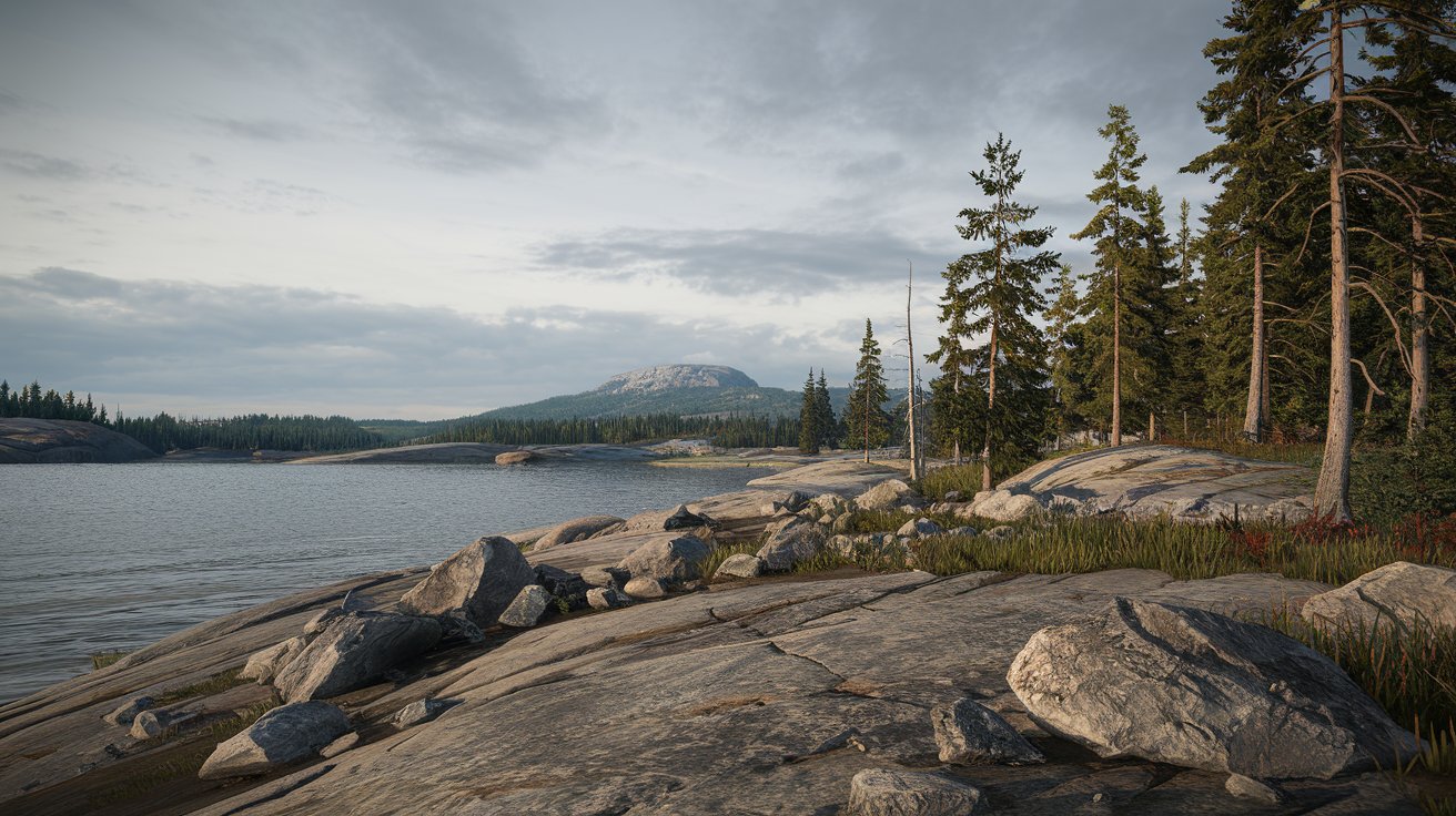
What makes this region truly exceptional is its exposed bedrock that reveals Earth’s geological story. Unlike other areas covered by sediment, the Canadian Shield’s surface was scraped clean by massive glaciers during the last ice age, exposing the ancient rock formations beneath. This natural excavation created a living laboratory for geologists, allowing them to study rock formations that are typically buried thousands of feet underground in other parts of the world.
Where Is the Canadian Shield Located and How Large Is It
The Canadian Shield location spans an enormous area of approximately 8 million square kilometers, making it larger than the entire European Union. This massive geological formation covers about 50 percent of Canada’s total land area, extending across Ontario, Quebec, Manitoba, Saskatchewan, Nunavut, and the Northwest Territories. The shield also reaches into the northern United States, with portions visible in Minnesota, Wisconsin, Michigan, and New York’s Adirondack Mountains.
The region forms a distinctive horseshoe shape around Hudson Bay, with the bay itself sitting in the shield’s center like a geological bull’s eye. This unique configuration resulted from the weight of ancient glaciers pressing down on the Earth’s crust, creating a depression that eventually filled with water. In 2026, researchers continue using satellite imagery to study how the land is still slowly rebounding from the glacier’s weight, rising approximately 2 centimeters per year in some areas.
How Did the Canadian Shield Get Its Name
The Canadian Shield name originated from its distinctive shield-like shape when viewed on a map, resembling a warrior’s protective shield centered around Hudson Bay. Canadian geologists in the early 20th century adopted this term to describe the region’s appearance and its role as the stable foundation or “shield” upon which much of North America was built. The name perfectly captures both the geographical appearance and the geological function of this ancient rock formation.
Alternative names for this region include the Laurentian Plateau and the Precambrian Shield, each highlighting different aspects of its character. The term Laurentian refers to the Laurentian Mountains in Quebec, which are part of this vast formation. Indigenous peoples who have lived on these lands for thousands of years have their own names for different sections, reflecting deep cultural connections to specific areas within this massive geological region.
Amazing Facts About Animals Living in the Canadian Shield
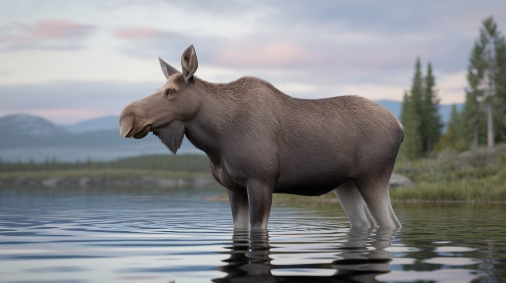
The Canadian Shield animals have adapted remarkably to survive in this rugged landscape characterized by boreal forests, countless lakes, and harsh winters. Large mammals including moose, black bears, wolves, and caribou thrive throughout the region, while smaller species like beavers, otters, and lynx populate the waterways and forests. In 2026, wildlife biologists estimate the shield supports over 300 vertebrate species, creating one of North America’s most diverse ecosystems despite the challenging climate conditions.
The region’s extensive water systems support incredible fish populations, with species like walleye, northern pike, lake trout, and yellow perch flourishing in the shield’s estimated 2 million lakes. These water bodies, formed by glacial activity, create perfect habitats for both fish and the numerous bird species that depend on them. Migratory birds including loons, Canada geese, and various duck species use the shield’s lakes as breeding grounds, with some areas hosting populations that travel thousands of miles annually.
Unique Wildlife Adaptations in the Shield
Animals in the Canadian Shield habitat have developed extraordinary adaptations to survive temperatures ranging from minus 40 degrees Fahrenheit in winter to 80 degrees Fahrenheit in summer. Woodland caribou have evolved wide, concave hooves that act like snowshoes, allowing them to traverse deep snow efficiently. Black bears in the region undergo hyperphagia in fall, consuming up to 20,000 calories daily to prepare for hibernation periods lasting up to seven months in the northern sections.
Threatened Species and Conservation Efforts
Several Canadian Shield species face conservation challenges in 2026, with woodland caribou populations declining due to habitat fragmentation and climate change. Conservation organizations have established protected corridors spanning over 500,000 square kilometers to help maintain genetic diversity. The region also supports healthy wolf populations that play crucial roles in ecosystem balance, though they sometimes conflict with human activities in areas where the shield meets agricultural lands.
Does the Canadian Shield Have Diamonds and Other Precious Resources
Yes, the Canadian Shield contains diamonds and ranks as one of the world’s most productive diamond-mining regions since discoveries in the 1990s. The Ekati and Diavik diamond mines in the Northwest Territories produce millions of carats annually, with Canadian diamonds valued for their ethical sourcing and high quality. In 2026, Canada ranks as the third-largest diamond producer globally by value, with virtually all production coming from shield deposits formed billions of years ago under extreme pressure and temperature.
Beyond diamonds, the shield contains extraordinary mineral wealth including gold, silver, copper, nickel, zinc, uranium, and iron ore. The Sudbury Basin in Ontario holds one of Earth’s largest nickel deposits, formed by a meteorite impact approximately 1.85 billion years ago. Mining operations throughout the shield contribute over 40 billion dollars annually to the Canadian economy, with American companies maintaining significant investments in numerous extraction projects across the region.
Natural Resources That Shaped North American Development
The natural resources in the Canadian Shield fundamentally shaped North American economic development throughout the 19th and 20th centuries. Vast forests covering approximately 1.5 million square kilometers provide timber for construction and paper industries, while hydroelectric potential from the region’s rivers generates over 75,000 megawatts of clean electricity. These renewable resources continue supporting both Canadian and United States energy needs, with power transmission lines carrying shield-generated electricity to major American cities including New York and Boston.
Mining Operations and Economic Impact
Modern mining in the Canadian Shield employs advanced technologies including autonomous vehicles and remote operations to extract resources while minimizing environmental impact. The region hosts over 200 active mining operations in 2026, producing critical materials for electric vehicle batteries, electronics, and renewable energy systems. American mining companies have invested over 15 billion dollars in shield operations, creating economic partnerships that benefit communities on both sides of the border.
Understanding the Canadian Shield Climate and Weather Patterns
The Canadian Shield climate varies dramatically across its vast expanse, ranging from subarctic conditions in the north to humid continental climate in southern regions. Northern areas experience long, extremely cold winters with temperatures dropping below minus 40 degrees Fahrenheit, while short summers bring surprisingly warm conditions with up to 20 hours of daylight. Southern shield regions enjoy more moderate temperatures but still face harsh winters, with annual temperature ranges exceeding 80 degrees Fahrenheit between January and July averages.
Precipitation patterns across the shield demonstrate remarkable variation, with annual totals ranging from 12 inches in northern sections to over 40 inches in southeastern areas near the Great Lakes. The region’s countless lakes create localized weather effects, moderating temperatures and increasing snowfall through lake-effect systems similar to those affecting American cities like Buffalo and Syracuse. In 2026, climate researchers document gradual warming trends, with winter temperatures rising approximately 3 degrees Fahrenheit over the past three decades, affecting ice formation patterns on thousands of shield lakes.
How Was the Canadian Shield Formed Over Billions of Years
The Canadian Shield formation began approximately 4 billion years ago through volcanic activity, mountain building, and the collision of ancient tectonic plates. Multiple geological periods contributed layers of igneous and metamorphic rock that fused together, creating the incredibly hard and stable foundation visible today. Ancient mountain ranges once towered over this region, rivaling the Himalayas in height, but billions of years of erosion wore them down to the relatively flat, rolling landscape we observe in 2026.
Glaciation played the most recent and visible role in shaping the shield’s current appearance. During the last ice age, massive ice sheets up to 2 miles thick covered the entire region, grinding down the surface and scraping away softer rock layers. As glaciers retreated approximately 10,000 years ago, they left behind the exposed bedrock, countless lakes in depressions, and the thin soil layer that characterizes much of the shield today. This glacial sculpting created the distinctive landscape of rock outcrops, wetlands, and interconnected waterways that define the region.
Geological Processes That Created Unique Rock Formations
The shield’s rock formations include incredible examples of granite, gneiss, and other igneous and metamorphic rocks formed under extreme conditions deep within Earth’s crust. Volcanic activity billions of years ago created greenstone belts that now host many of the region’s valuable mineral deposits. Scientists study these formations to understand plate tectonics and continental drift, as the shield represents the ancient core around which the North American continent assembled over geological time.
Evidence of Ancient Supercontinents
Rocks within the Canadian Shield preserve evidence of ancient supercontinents including Kenorland, Nuna, and Rodinia that existed billions of years before Pangaea. Geologists analyze mineral compositions and magnetic orientations in shield rocks to reconstruct how continents moved and collided throughout Earth’s history. These studies reveal that the shield has been part of at least three different supercontinents, each assembling and breaking apart over hundreds of millions of years, fundamentally reshaping global geography.
Fascinating Geographic Features and Landscapes
The Canadian Shield geography encompasses an extraordinary variety of landscapes despite its relatively low elevation, with most areas sitting between 300 and 600 meters above sea level. The region contains over 2 million lakes connected by countless rivers and streams, creating one of Earth’s largest freshwater systems. These water bodies hold approximately 20 percent of the world’s fresh surface water, a resource of increasing global importance as water scarcity affects other regions worldwide.
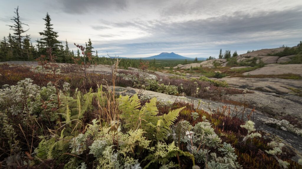
Distinctive landforms throughout the shield include dramatic rock outcrops and cliffs that reveal billions of years of geological history in exposed layers. The Niagara Escarpment, though technically at the shield’s edge, demonstrates the dramatic topography where the ancient shield meets younger sedimentary rocks. Interior regions feature rolling hills, extensive wetlands, and vast stretches of boreal forest interrupted by bare rock expanses where thin soils cannot support tree growth. These varied landscapes create diverse ecosystems supporting the region’s remarkable biodiversity.
The Shield’s Impact on Canadian and American Culture
The Canadian Shield cultural influence extends throughout both Canadian and American history, shaping settlement patterns, economic development, and cultural identity. Indigenous peoples including Cree, Ojibwe, and Inuit nations have inhabited shield lands for thousands of years, developing deep cultural connections and traditional ecological knowledge that continues informing conservation efforts in 2026. European exploration of the shield drove the fur trade that became foundational to early Canadian economy, with trading routes established along the region’s extensive river systems.
For Americans, the shield’s southern extensions into states like Minnesota and Wisconsin created distinctive regional cultures centered on logging, mining, and outdoor recreation. The boundary waters region between Minnesota and Ontario attracts hundreds of thousands of American visitors annually, seeking wilderness experiences in pristine shield landscapes. American artists including painters from the Hudson River School captured shield scenery, while contemporary environmental movements draw inspiration from the region’s vast, relatively undeveloped wilderness areas that offer contrasts to urbanized landscapes farther south.
Fun Facts About the Canadian Shield for Students and Educators
Students researching the Canadian Shield discover numerous fascinating facts that make this geological formation an excellent educational topic. The shield is older than the first complex life forms on Earth, with its oldest rocks forming before even simple multicellular organisms evolved. This means the bedrock beneath your feet predates dinosaurs by over 4 billion years, representing nearly 90 percent of Earth’s entire history. The region’s rocks contain some of Earth’s oldest fossils, including stromatolites created by ancient bacterial colonies.
The shield’s environmental significance extends far beyond Canada’s borders, with its forests absorbing approximately 25 percent of North America’s carbon dioxide emissions annually. These boreal forests represent one of the planet’s most important carbon sinks, storing an estimated 208 billion tons of carbon in trees, soil, and peatlands. For American students studying climate change, understanding the shield’s role in global carbon cycling provides valuable context for environmental science curricula. The region also influences weather patterns across the United States, with cold air masses forming over the shield affecting temperatures as far south as Texas during winter cold snaps.
Educational Resources and Field Trip Opportunities
Numerous educational programs connect American students with Canadian Shield ecosystems through partnerships between U.S. and Canadian institutions. The Boundary Waters Canoe Area Wilderness in Minnesota offers accessible shield experiences for school groups, while museums throughout the Great Lakes region feature shield geology exhibits. In 2026, virtual reality programs allow students to explore shield environments remotely, examining rock formations and wildlife habitats through immersive technology that brings this remarkable region into classrooms across the United States.
Scientific Research and Discovery Opportunities
The Canadian Shield continues serving as an active research location for scientists studying climate change, geology, and ecology. American universities maintain research stations throughout the region, investigating topics from forest fire ecology to glacial rebound rates. Students pursuing careers in environmental science, geology, or wildlife biology find exceptional research opportunities within shield ecosystems, with many undergraduate and graduate programs offering field courses that provide hands-on experience in this unique environment.
Recreational Activities and Tourism in the Shield Region
The Canadian Shield attracts millions of tourists annually, including substantial numbers of American visitors seeking outdoor adventures in pristine wilderness settings. Activities range from fishing in remote lakes to canoeing expeditions following historic fur trade routes. The region offers exceptional opportunities for viewing northern lights, with dark skies free from light pollution providing spectacular aurora displays visible from September through April. Popular destinations like Algonquin Provincial Park in Ontario welcome over 800,000 visitors yearly, many traveling from United States cities seeking weekend wilderness escapes.
Winter recreation throughout the shield includes ice fishing, snowmobiling, and skiing, with some areas receiving over 300 inches of annual snowfall that creates ideal conditions for winter sports. American outdoor enthusiasts particularly value the region’s backcountry camping opportunities, with thousands of remote lakes accessible only by canoe or floatplane offering solitude impossible to find in more developed areas. In 2026, eco-tourism continues growing, with visitors seeking sustainable experiences that minimize environmental impact while supporting local communities dependent on tourism revenue.
Environmental Challenges and Conservation Efforts
Despite its vast size, the Canadian Shield faces environmental pressures from climate change, resource extraction, and industrial development. Warming temperatures threaten boreal forest composition, with southern tree species gradually migrating northward and altering ecosystem dynamics. Permafrost thawing in northern sections releases methane and carbon dioxide, creating feedback loops that accelerate warming. Forest fires have increased in frequency and intensity over recent decades, with some years seeing over 5 million acres burned across shield regions.
Conservation organizations work to protect critical shield ecosystems through expanding protected areas and promoting sustainable resource management. Indigenous-led conservation initiatives have established numerous protected areas totaling over 2 million square kilometers, combining traditional ecological knowledge with modern conservation science. These efforts benefit Americans by preserving watersheds flowing into the Great Lakes, maintaining migratory bird habitats, and protecting carbon storage that helps mitigate global climate change. Cross-border partnerships between Canadian provinces and U.S. states coordinate conservation strategies for species ranging from wolves to lake sturgeon that move between countries throughout their life cycles.
Related video about fun facts about the canadian shield
This video complements the article information with a practical visual demonstration.
Important things to know about fun facts about the canadian shield
What are 10 fun facts about the Canadian Shield?
The Canadian Shield contains Earth’s oldest rocks at 4.28 billion years old, covers 8 million square kilometers, holds 20 percent of the world’s fresh surface water in over 2 million lakes, produces diamonds worth billions annually, was completely covered by ice sheets 2 miles thick during the last ice age, supports over 300 vertebrate species, stores 208 billion tons of carbon, extends into five U.S. states, has land still rising 2 centimeters yearly from glacial rebound, and contains rock formations from three ancient supercontinents. These facts demonstrate why the shield remains one of North America’s most remarkable geological features in 2026.
Does the Canadian Shield have diamonds?
Yes, the Canadian Shield contains significant diamond deposits and ranks as the world’s third-largest diamond producer by value in 2026. Major diamond mines in the Northwest Territories including Ekati and Diavik produce millions of carats annually. These diamonds formed billions of years ago deep within Earth’s mantle under extreme pressure and temperature, then volcanic eruptions brought them closer to the surface where they remained preserved in the ancient shield rocks. Canadian diamonds are particularly valued for ethical sourcing and high quality, with the industry contributing significantly to both Canadian and American economies through investments and diamond trade.
What animals live in the Canadian Shield?
The Canadian Shield supports diverse wildlife including large mammals like moose, black bears, wolves, caribou, and lynx, along with smaller species such as beavers, otters, foxes, and snowshoe hares. The region’s extensive water systems host fish populations including walleye, northern pike, lake trout, and yellow perch. Bird species are abundant, with loons, Canada geese, bald eagles, and numerous migratory waterfowl using the shield’s millions of lakes for breeding grounds. In 2026, wildlife biologists estimate over 300 vertebrate species thrive in shield ecosystems, demonstrating remarkable adaptation to the challenging climate and rugged terrain that characterize this vast geological region.
How was the Canadian Shield formed?
The Canadian Shield formed approximately 4 billion years ago through volcanic activity, tectonic plate collisions, and mountain-building processes that created layers of igneous and metamorphic rock. Ancient mountain ranges once towered over the region but eroded over billions of years. The most recent major shaping occurred during the last ice age when glaciers up to 2 miles thick scraped away softer rock layers, creating the exposed bedrock visible today. As glaciers retreated 10,000 years ago, they left behind countless lakes in depressions and the thin soil layer characteristic of the shield. This geological history makes the shield one of Earth’s oldest and most stable continental formations in 2026.
Where is the Canadian Shield located?
The Canadian Shield covers approximately 50 percent of Canada’s land area, spanning across Ontario, Quebec, Manitoba, Saskatchewan, Nunavut, and the Northwest Territories in a distinctive horseshoe shape around Hudson Bay. The shield extends south into the United States, with portions visible in Minnesota, Wisconsin, Michigan, and New York’s Adirondack Mountains. This massive geological formation covers about 8 million square kilometers, making it larger than the European Union. The shield’s southern boundary roughly follows the Great Lakes region, while its northern extent reaches into the Arctic, demonstrating the enormous scale of this ancient rock formation that forms the geological foundation of much of North America.
What is the Canadian Shield climate like?
The Canadian Shield climate ranges from subarctic in the north to humid continental in southern regions, with extreme temperature variations throughout the year. Northern areas experience winters reaching minus 40 degrees Fahrenheit and brief summers with up to 20 hours of daylight. Southern shield regions have more moderate conditions but still face harsh winters with temperatures well below freezing for months. Annual precipitation varies from 12 inches in the north to over 40 inches near the Great Lakes. The region’s countless lakes create localized weather effects that moderate temperatures and increase snowfall. In 2026, climate research shows warming trends affecting the shield, with winter temperatures rising approximately 3 degrees Fahrenheit over three decades.
| Key Aspect | Important Details | Significance |
|---|---|---|
| Age and Size | 4.28 billion years old, covers 8 million square kilometers | One of Earth’s oldest exposed rock formations, reveals planetary history |
| Water Resources | Over 2 million lakes, 20% of world’s fresh surface water | Critical freshwater reserve for North America and global water security |
| Mineral Wealth | Diamonds, gold, nickel, copper, uranium deposits worth billions | Drives economic development, supplies critical industrial materials |
| Biodiversity | Over 300 vertebrate species, vast boreal forest ecosystems | Supports wildlife populations, provides habitat for migratory species |
| Carbon Storage | 208 billion tons stored in forests, soil, and peatlands | Essential for climate regulation, absorbs 25% of North American CO2 emissions |
| Recreation Value | Millions of annual visitors, wilderness experiences, outdoor activities | Tourism revenue, cultural significance, educational opportunities for Americans |