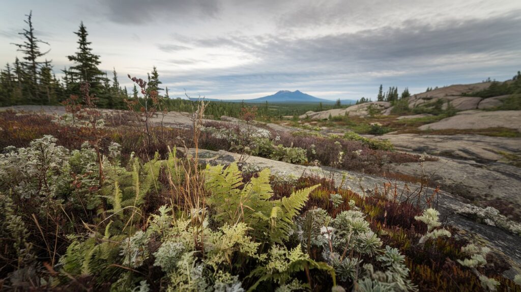
The Canadian Shield is one of Earth’s oldest and most remarkable geological formations, covering approximately 8 million square kilometers across Canada and extending into parts of the northern United States. This ancient shield contains some of the planet’s oldest rocks, dating back 4.5 billion years, and holds tremendous natural resources including gold, copper, nickel, and diamonds. Understanding these interesting facts about the Canadian Shield reveals how this massive geological feature has shaped North American geography, ecology, and economic development for millennia.
What Is the Canadian Shield and Why Is It Called That
The Canadian Shield, also known as the Laurentian Plateau, is a massive exposed section of the Earth’s ancient continental crust. This geological formation consists primarily of Precambrian igneous and metamorphic rocks that have been worn down by billions of years of erosion and multiple ice ages. The term shield comes from its distinctive shape resembling a warrior’s shield centered on Hudson Bay, with the rocks forming a protective basement layer beneath much of North America.
Geologists identify the Canadian Shield as a craton, which is a stable portion of the continental lithosphere that has remained relatively unchanged for billions of years. This ancient landmass extends across more than half of Canada’s total land area, covering significant portions of Ontario, Quebec, Manitoba, Saskatchewan, Alberta, the Northwest Territories, Nunavut, and Labrador. The shield also reaches into the United States, including parts of northern Minnesota, Wisconsin, Michigan, and northeastern New York State, particularly in the Adirondack Mountains region.
How Was the Canadian Shield Formed: Billions of Years in the Making
The formation of the Canadian Shield began approximately 4.5 billion years ago during Earth’s early history, making it one of the oldest geological structures on the planet. The shield formed through a complex process involving volcanic activity, tectonic plate movements, and the collision of ancient micro-continents. These geological events created the foundation of what would become the North American continent, with successive layers of volcanic rock cooling and solidifying into the Precambrian bedrock visible today.
During the Archean Eon, between 4 and 2.5 billion years ago, intense volcanic activity and the collision of primitive tectonic plates formed the core of the Canadian Shield. Subsequent mountain-building episodes, known as orogenies, added layers of metamorphic rocks as extreme heat and pressure transformed existing minerals. The most recent major influence on the shield’s appearance came from repeated glaciation cycles over the past 2.5 million years, which scraped away softer sedimentary layers and exposed the ancient crystalline bedrock beneath. These massive ice sheets, some over 3 kilometers thick, carved out the region’s characteristic landscape of lakes, rivers, and relatively flat terrain.
10 Fascinating Facts About the Canadian Shield
Understanding the most interesting facts about the Canadian Shield helps appreciate this remarkable geological wonder that influences everything from mineral extraction to freshwater ecosystems across North America.
Fact 1: Home to Earth’s Oldest Known Rocks
The Canadian Shield contains the Acasta Gneiss in the Northwest Territories, which dates back approximately 4.03 billion years, making it among the oldest known intact rock formations on Earth. Scientists discovered even older mineral crystals called zircons in Jack Hills, but the Acasta Gneiss represents some of the oldest substantial bedrock formations. These ancient rocks provide crucial evidence about Earth’s early geological processes and the formation of the first continents. In 2026, ongoing research continues to reveal new insights about planetary formation by studying these ancient Canadian Shield rocks.
Fact 2: Contains Massive Mineral Wealth and Natural Resources
The natural resources in the Canadian Shield make it one of the world’s richest mining regions, producing significant quantities of gold, silver, copper, zinc, nickel, iron ore, uranium, and diamonds. In 2026, the shield region accounts for approximately 85% of Canada’s mineral production by value, contributing billions of dollars annually to the national economy. Major mining operations in Ontario’s Sudbury Basin extract nickel and copper from deposits formed by a massive meteorite impact 1.85 billion years ago. The discovery of diamonds in the Northwest Territories during the 1990s transformed that region into a globally significant diamond-producing area, with several major mines currently operational across the Canadian Shield.
Fact 3: Covers Nearly Half of Canada’s Land Area
The Canadian Shield spans an impressive 8 million square kilometers (approximately 3.1 million square miles), making it one of the world’s largest geological shields and covering roughly 48% of Canada’s total land area. This massive landmass extends from the Great Lakes northward to the Arctic Ocean and from western Alberta eastward to Labrador and Newfoundland. The shield’s southern boundary reaches into the northern United States, affecting the geology and landscape of the Great Lakes region. This enormous geographic footprint means the Canadian Shield significantly influences North American climate patterns, hydrology, and biodiversity across multiple climate zones.
Fact 4: Shaped by Multiple Ice Ages
The Canadian Shield’s current landscape owes its distinctive appearance to at least four major glaciation periods during the Pleistocene Epoch, with the most recent ice sheet retreating approximately 10,000 years ago. These massive continental glaciers, sometimes exceeding 3 kilometers in thickness, scraped across the shield surface like enormous bulldozers, removing softer sedimentary rock layers and exposing the ancient crystalline basement rocks beneath. The glacial action created the region’s characteristic features including thousands of lakes, scraped bedrock surfaces, erratic boulders, eskers, drumlins, and thin or absent soil layers. This glacial sculpting explains why the Canadian Shield region has such poor agricultural potential but exceptional freshwater resources.
Fact 5: Creates a Land of Millions of Lakes
The Canadian Shield contains an estimated 60% of the world’s lakes, with hundreds of thousands of water bodies ranging from small ponds to massive lakes like Great Bear Lake and Great Slave Lake. This extraordinary concentration of freshwater lakes resulted from glacial scouring that created countless depressions in the bedrock, which filled with meltwater as the ice sheets retreated. Ontario alone, largely situated on the Canadian Shield, claims to have over 250,000 lakes, while the entire shield region may contain more than 2 million lakes depending on minimum size criteria. These freshwater resources represent approximately 20% of the world’s fresh surface water, making the Canadian Shield critically important for global water security in 2026.
Fact 6: Supports Unique Boreal Forest Ecosystems
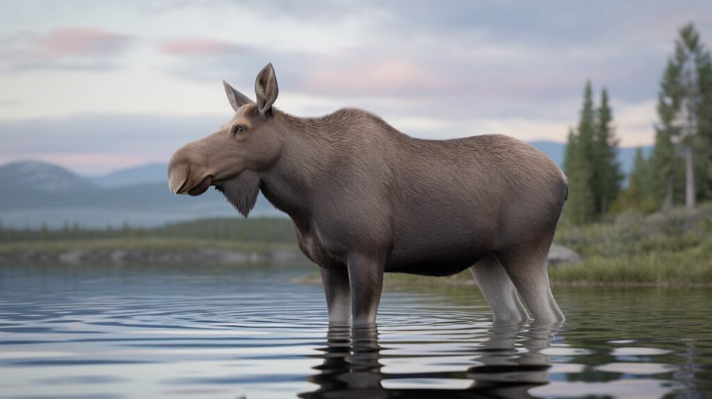
The Canadian Shield supports vast stretches of boreal forest, also called taiga, which represents one of Earth’s largest terrestrial biomes and acts as a crucial carbon sink for the planet. This boreal ecosystem features predominantly coniferous trees such as black spruce, white spruce, jack pine, and balsam fir, interspersed with deciduous species like birch and poplar in southern areas. The thin, acidic soils typical of the shield region create challenging growing conditions, resulting in slower tree growth compared to more fertile regions. Despite these challenges, the Canadian Shield’s forests provide critical habitat for species including moose, caribou, black bears, wolves, lynx, and numerous migratory bird species that rely on these northern forests for breeding grounds.
Fact 7: Has Extremely Low Population Density
The Canadian Shield population remains remarkably sparse, with vast areas having fewer than one person per square kilometer despite covering nearly half of Canada’s land area. As of 2026, approximately 10% of Canada’s population lives within the shield region, concentrated primarily in southern cities like Sudbury, Thunder Bay, and Sept-Îles that developed around mining operations. The challenging environmental conditions including rocky terrain, thin soils unsuitable for agriculture, harsh winters, and remoteness from major transportation networks have historically discouraged large-scale settlement. Many shield communities are Indigenous settlements, mining towns, or resource extraction centers, with thousands of square kilometers remaining essentially uninhabited wilderness.
Fact 8: Features Dramatic Seasonal Temperature Variations
The Canadian Shield climate experiences extreme seasonal temperature variations, with winter temperatures regularly dropping below -30°C (-22°F) and summer temperatures occasionally exceeding 30°C (86°F), creating an annual temperature range surpassing 60°C (108°F) in some locations. The continental climate of the shield region results from its distance from moderating ocean influences and its northern latitude, producing long, bitterly cold winters and relatively short but warm summers. Precipitation patterns vary considerably across the shield, with southern areas receiving 750-1000 millimeters annually while northern regions may receive less than 400 millimeters, much falling as snow. These extreme climate conditions significantly influence vegetation patterns, wildlife adaptations, and human settlement patterns across the region.
Fact 9: Reveals Evidence of Ancient Mountain Ranges
Although the Canadian Shield appears relatively flat today, geological evidence reveals that ancient mountain ranges once towered across this region, comparable in scale to the modern Himalayas. These Precambrian mountain chains formed during multiple orogenic events between 3 billion and 1 billion years ago as tectonic plates collided and continental fragments merged. Billions of years of erosion, weathering, and glaciation have since worn these mountains down to their roots, exposing the metamorphic and igneous rocks that formed deep within their cores. The Grenville Province, visible in parts of Ontario and Quebec, represents the eroded remains of mountains formed during the Grenville Orogeny approximately 1 billion years ago, demonstrating the shield’s dynamic geological history.
Fact 10: Continues to Rise Through Isostatic Rebound
The Canadian Shield is literally rising, still rebounding from the immense weight of ice age glaciers in a process called isostatic or post-glacial rebound. During peak glaciation, ice sheets up to 3 kilometers thick pressed the Earth’s crust downward into the more fluid mantle beneath. Since the ice melted approximately 10,000 years ago, the shield has been gradually rising as the crust slowly returns to equilibrium, with some areas around Hudson Bay currently rising at rates of 1-2 centimeters per year. This ongoing geological uplift affects everything from water levels in the Great Lakes to the elevation of ancient shorelines now found far inland, with scientists estimating the rebound process will continue for several thousand more years before reaching equilibrium.
Why Is the Canadian Shield Important to North America
The importance of the Canadian Shield extends far beyond its geological significance, playing crucial roles in North American ecology, economy, and climate regulation. This ancient landmass serves as the foundation for much of the continent, providing the stable bedrock platform upon which younger sedimentary rocks were deposited in surrounding regions. The shield’s mineral wealth has driven economic development across Canada for over a century, with mining operations providing thousands of jobs and generating billions in export revenue annually. Major Canadian cities including Toronto, Ottawa, Montreal, and Winnipeg all sit on or near the shield’s margins, where the transition to more fertile lands enabled agricultural development.
From an ecological perspective, the Canadian Shield’s vast boreal forests and wetlands act as a massive carbon sink, absorbing atmospheric carbon dioxide and helping mitigate climate change on a global scale. The region’s millions of lakes and extensive river systems form the headwaters for major waterways including the Mackenzie, Nelson, and Churchill rivers, supplying freshwater to millions of people and supporting commercial fisheries. In 2026, as freshwater scarcity becomes an increasingly critical global issue, the Canadian Shield’s freshwater reserves represent a strategic resource of incalculable value. The shield also provides critical habitat for hundreds of species and serves as vital breeding grounds for billions of migratory birds that travel across the Americas each year.
Canadian Shield Landmarks and Notable Features
Several remarkable Canadian Shield landmarks attract visitors and researchers interested in experiencing this ancient geological wonder firsthand. The Sudbury Basin in Ontario, formed by a massive meteorite impact 1.85 billion years ago, creates one of Earth’s largest impact craters and hosts world-class mining operations extracting nickel and copper. Algonquin Provincial Park in Ontario showcases classic shield landscape features including rocky outcrops, pristine lakes, and dense boreal forest across 7,653 square kilometers of protected wilderness. The Temagami region, also in Ontario, features old-growth red and white pine forests growing on ancient bedrock, with some trees exceeding 300 years old.
In Quebec, La Mauricie National Park protects representative Canadian Shield ecosystems including mixed forests, numerous lakes, and abundant wildlife within easy reach of major population centers. The Torngat Mountains in northern Labrador represent the shield’s eastern edge, where ancient rocks meet the Atlantic Ocean in dramatic fjords and towering peaks exceeding 1,500 meters. Great Slave Lake in the Northwest Territories, the deepest lake in North America at 614 meters, occupies a glacially-carved basin in the shield’s bedrock. These landmarks and protected areas offer opportunities for outdoor recreation including canoeing, hiking, fishing, and wildlife viewing while preserving examples of the shield’s diverse landscapes for future generations.
Natural Resources and Economic Significance in 2026
The natural resources in the Canadian Shield continue to drive significant economic activity across Canada and export valuable commodities to global markets, including the United States. In 2026, active mining operations across the shield extract gold, silver, copper, zinc, nickel, iron ore, uranium, platinum group metals, and diamonds, with total mineral production values exceeding $45 billion CAD annually. The Ring of Fire region in northern Ontario contains massive chromite deposits representing potentially one of the largest mining developments in Canadian history, though development faces ongoing challenges related to infrastructure, environmental protection, and Indigenous consultation.
Beyond metallic minerals, the Canadian Shield provides substantial forestry resources, with sustainable timber harvesting operations supplying lumber and pulp to domestic and international markets. Hydroelectric development has transformed many shield rivers into major power generation sources, with facilities in Quebec, Ontario, Manitoba, and Labrador producing thousands of megawatts of renewable electricity. The Churchill Falls generating station in Labrador, for example, produces 5,428 megawatts, making it one of the world’s largest underground power plants. As global demand for critical minerals needed in renewable energy technologies and electric vehicles continues growing, the Canadian Shield’s vast mineral resources position it as a strategically important supplier of cobalt, lithium, nickel, and rare earth elements essential for the clean energy transition.
Fun Things to Do in the Canadian Shield Region
Visitors wondering about fun things to do in the Canadian Shield will find diverse recreational opportunities ranging from wilderness adventures to cultural experiences. The region’s countless lakes and rivers provide world-class opportunities for canoeing and kayaking, with routes ranging from day trips to multi-week expeditions through pristine wilderness. The Boundary Waters area along the Minnesota-Ontario border offers exceptional paddling experiences, while Quetico Provincial Park provides backcountry canoeing through a landscape largely unchanged since the ice age. Sport fishing attracts anglers pursuing northern pike, walleye, lake trout, and smallmouth bass in cold, clear shield waters.
Hiking trails across the Canadian Shield range from easy nature walks to challenging backcountry routes, with the La Cloche Silhouette Trail in Killarney Provincial Park offering spectacular views of white quartzite ridges and turquoise lakes. Winter activities include cross-country skiing, snowshoeing, ice fishing, and snowmobiling across vast networks of groomed trails. Wildlife viewing opportunities abound, with possibilities to observe moose, black bears, wolves, bald eagles, and loons in their natural habitats. Educational experiences include visiting active or historic mining sites, Indigenous cultural centers, and interpretive programs explaining the shield’s geological history. For those seeking less strenuous activities, scenic drives along highways crossing the shield offer stunning vistas, particularly during autumn when deciduous trees create spectacular fall colors against evergreen backdrops and rocky outcrops.
Canadian Shield’s Role in Climate and Water Cycles
The Canadian Shield plays a crucial role in North American and global climate systems through its influence on atmospheric circulation, carbon storage, and freshwater distribution. The vast boreal forests covering much of the shield store enormous quantities of carbon in both living biomass and thick organic soils, with estimates suggesting the boreal forest biome stores approximately 30% of Earth’s terrestrial carbon. This carbon sequestration helps moderate atmospheric carbon dioxide concentrations, though rising temperatures and increased forest fire frequency in recent years have raised concerns about the boreal forest transitioning from carbon sink to carbon source.
The shield’s millions of lakes and extensive wetlands significantly influence regional water cycles and climate patterns. These freshwater systems moderate local temperatures, create habitat for diverse species, and provide essential breeding grounds for waterfowl and other wildlife. The relatively low elevation and gentle topography of much of the Canadian Shield allow it to function as a massive watershed, collecting precipitation and gradually releasing it through countless streams and rivers that flow toward Hudson Bay, the Atlantic Ocean, and the Arctic Ocean. In 2026, climate change impacts on the shield region include warming temperatures, shifting precipitation patterns, thawing permafrost in northern areas, and changes in lake ice duration, all of which have cascading effects on ecosystems, communities, and resource industries dependent on stable environmental conditions.
Indigenous Peoples and Cultural Heritage of the Shield
Indigenous peoples have inhabited the Canadian Shield region for at least 10,000 years, since the retreat of the glaciers, developing deep cultural connections and sophisticated adaptations to the challenging shield environment. First Nations groups including the Cree, Ojibwe, Algonquin, Innu, and Dene traditionally lived across various parts of the shield, relying on hunting, fishing, trapping, and gathering for subsistence. These communities developed extensive knowledge of the land, seasonal cycles, wildlife behavior, and plant resources, passing this information through generations via oral traditions and lived experience.
Today, numerous Indigenous communities continue living throughout the Canadian Shield region, maintaining cultural practices while adapting to contemporary circumstances. Many communities face significant challenges including limited economic opportunities, inadequate infrastructure, and impacts from resource extraction projects on traditional territories. However, Indigenous peoples increasingly assert rights and interests in shield land management, participating in environmental monitoring, negotiating impact and benefit agreements with mining companies, and developing tourism operations that share cultural knowledge with visitors. In 2026, reconciliation efforts and recognition of Indigenous rights shape resource development decisions across the Canadian Shield, with companies required to consult meaningfully with affected communities before undertaking major projects. The cultural heritage and traditional ecological knowledge of Indigenous peoples provide invaluable perspectives on sustainable shield resource management and environmental stewardship.
Related video about interesting facts about the canadian shield
This video complements the article information with a practical visual demonstration.
Essential Q&A about interesting facts about the canadian shield
Is the Canadian Shield the oldest geological formation on Earth?
The Canadian Shield contains some of Earth’s oldest rocks, including the Acasta Gneiss dated at approximately 4.03 billion years old, making it among the oldest substantial bedrock formations on the planet. However, even older mineral crystals called zircons, dated up to 4.4 billion years old, have been found in Australia’s Jack Hills region. While not definitively the oldest, the Canadian Shield represents one of the most extensive and well-preserved examples of ancient continental crust, providing crucial insights into Earth’s early geological history and the formation of the first continents during the Archean Eon.
Why is the Canadian Shield important for freshwater resources?
The Canadian Shield contains approximately 60% of the world’s lakes and represents roughly 20% of Earth’s fresh surface water, making it critically important for global water security. The region’s millions of lakes formed when glacial scouring created countless depressions in the bedrock that filled with meltwater as ice sheets retreated. These freshwater resources supply drinking water to millions of people, support commercial and recreational fisheries, generate hydroelectric power, and provide essential habitat for countless species. In 2026, as freshwater scarcity becomes an increasingly urgent global concern, the Canadian Shield’s vast water reserves represent a strategic resource of immense value for future generations.
What natural resources are found in the Canadian Shield?
The Canadian Shield contains vast mineral wealth including gold, silver, copper, zinc, nickel, iron ore, uranium, platinum group metals, and diamonds, making it one of the world’s most productive mining regions. In 2026, the shield accounts for approximately 85% of Canada’s mineral production by value, contributing billions of dollars annually to the economy. Major mining areas include the Sudbury Basin for nickel and copper, the Abitibi greenstone belt for gold, and diamond mines in the Northwest Territories. The region also provides forestry resources from boreal forests and substantial hydroelectric power generation from rivers, with ongoing exploration identifying deposits of critical minerals like lithium, cobalt, and rare earth elements needed for clean energy technologies.
How does the Canadian Shield climate affect ecosystems and human settlement?
The Canadian Shield climate features extreme seasonal variations with bitterly cold winters often dropping below -30°C and relatively short, warm summers, creating challenging conditions for both ecosystems and human settlement. These conditions support boreal forest and tundra ecosystems adapted to cold temperatures, short growing seasons, and thin, acidic soils. The harsh climate and poor agricultural potential have resulted in very low population density across most of the shield, with settlement concentrated in southern areas and around mining operations. Wildlife species have evolved specific adaptations including hibernation, migration, and specialized insulation to survive the extreme conditions, while human communities require substantial infrastructure and resources to maintain year-round habitation in this challenging environment.
What are some notable Canadian Shield landmarks to visit?
Notable Canadian Shield landmarks include Algonquin Provincial Park in Ontario, which showcases classic shield landscape features including rocky outcrops, pristine lakes, and boreal forest across 7,653 square kilometers. The Sudbury Basin, formed by a massive meteorite impact 1.85 billion years ago, offers unique geological features and mining history. La Mauricie National Park in Quebec protects representative shield ecosystems with numerous lakes and hiking trails. Great Slave Lake in the Northwest Territories is North America’s deepest lake at 614 meters. The Torngat Mountains in Labrador feature dramatic fjords where ancient rocks meet the Atlantic Ocean. These landmarks provide opportunities for outdoor recreation including canoeing, hiking, fishing, and wildlife viewing while experiencing the shield’s ancient geology firsthand.
How was the Canadian Shield formed over billions of years?
The Canadian Shield formed approximately 4.5 billion years ago through complex geological processes involving volcanic activity, tectonic plate collisions, and mountain-building events. During the Archean Eon, intense volcanism and primitive plate tectonics created the core of the shield as molten rock cooled and solidified into crystalline bedrock. Subsequent collisions of micro-continents and mountain-building episodes added layers of metamorphic rocks transformed by extreme heat and pressure. The shield’s current appearance resulted from billions of years of erosion wearing down ancient mountain ranges to their roots, followed by repeated glaciation cycles over the past 2.5 million years that scraped away softer layers and exposed the ancient Precambrian bedrock visible today across vast areas of Canada and the northern United States.
| Key Aspect | Important Details | Significance |
|---|---|---|
| Age and Formation | Contains rocks up to 4.03 billion years old; formed through volcanic activity and tectonic collisions | Provides crucial evidence about Earth’s early geological history |
| Geographic Extent | Covers 8 million square kilometers; nearly 48% of Canada’s land area | One of world’s largest exposed Precambrian shields |
| Mineral Resources | Gold, copper, nickel, diamonds, uranium; 85% of Canada’s mineral production | Generates billions in economic value annually |
| Freshwater Resources | Contains 60% of world’s lakes; 20% of Earth’s fresh surface water | Critical for global water security and biodiversity |
| Climate Role | Boreal forests store 30% of Earth’s terrestrial carbon | Helps moderate atmospheric CO2 and climate patterns |
| Ecological Importance | Supports vast boreal forest ecosystems and provides habitat for hundreds of species | Essential breeding grounds for billions of migratory birds |