The Canadian Shield is one of North America’s most fascinating geological regions, covering nearly half of Canada’s land area with ancient rocks dating back billions of years. This massive horseshoe-shaped region stretches from Labrador to the Arctic and down into parts of the northern United States, including Minnesota, Wisconsin, and Michigan. For kids learning about North American geography, understanding the Canadian Shield opens doors to discovering incredible facts about Earth’s history, unique wildlife, and the natural resources that have shaped modern civilization.
What Is the Canadian Shield in Simple Words
The Canadian Shield is a massive area of exposed ancient rock that forms the geological core of North America. In simple terms, it’s like Earth’s basement floor showing through, with rocks that are between 2.5 and 4.3 billion years old. This rocky region covers approximately 1.9 million square miles, making it roughly the size of the entire continental United States east of the Mississippi River. The Shield got its name because its horseshoe shape resembles a warrior’s shield, wrapping around Hudson Bay in the center.
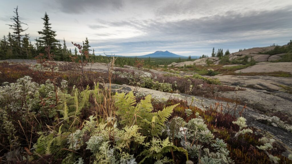
For kids trying to visualize this region, imagine a giant rocky plateau with thousands of lakes, rivers, and forests covering ancient stone. The Canadian Shield is mostly flat or gently rolling terrain, though it includes some mountainous areas. The rock beneath your feet in this region is some of the oldest on Earth, formed when our planet was still very young. This interesting geological formation has been scraped and shaped by massive glaciers during ice ages, creating the distinctive landscape we see today in 2026.
10 Facts About the Canadian Shield for Kids
Learning facts about the Canadian Shield helps kids understand why this region is so important to North American geography and history. Here are ten interesting facts that make the Canadian Shield unique and exciting to study.
Ancient Rocks and Geological History
The Canadian Shield contains some of the oldest rocks on Earth, with samples dating back 4.28 billion years found near Hudson Bay. These interesting ancient stones formed when Earth was still developing its crust, making this region a geological treasure. Scientists study these rocks to understand how our planet formed and evolved. The Shield is primarily composed of igneous and metamorphic rocks, including granite, gneiss, and greenstone, which were formed under intense heat and pressure deep beneath Earth’s surface.
The region’s rocks have survived multiple geological events, including mountain-building episodes and erosion cycles spanning billions of years. For kids interested in Earth science, the Canadian Shield serves as a natural laboratory showing our planet’s earliest history. In 2026, ongoing research continues to reveal new facts about these ancient formations, with universities in the United States and Canada regularly conducting studies in the area.
Lakes, Rivers, and Water Resources
The Canadian Shield contains millions of lakes and countless rivers, making it one of Earth’s largest freshwater reservoirs. Glaciers carved out deep basins in the ancient rock during ice ages, which later filled with water as the ice melted. This created the stunning lake-dotted landscape visible on any Canadian Shield map. Some estimates suggest the region contains over 2 million lakes, though many are small and unnamed. Major water bodies include the Great Lakes, Great Bear Lake, and Great Slave Lake.
These water resources are incredibly important for both Canada and the northern United States. The lakes provide drinking water for millions of people, support commercial fishing industries, and create habitats for diverse wildlife. For kids learning about water conservation, the Canadian Shield demonstrates why protecting freshwater sources matters. The region’s waterways also historically served as transportation routes for Indigenous peoples and later European explorers, making them culturally significant as well as ecologically important.
Canadian Shield Climate for Kids
Understanding the Canadian Shield climate helps kids appreciate how weather patterns affect this vast region. The Shield experiences what scientists call a subarctic or continental climate, with dramatic differences between summer and winter temperatures. In southern areas touching the United States, summers can be warm with temperatures reaching 70-80°F (21-27°C), while winters plunge well below freezing, often hitting -20°F (-29°C) or colder in January and February.
The northern portions of the Canadian Shield experience even more extreme conditions, with short, cool summers and long, harsh winters lasting seven to eight months. Annual precipitation varies across the region, with southern areas receiving 20-40 inches (50-100 cm) annually, much of it falling as snow during winter months. In 2026, climate scientists note that the Shield region is experiencing warming trends faster than global averages, with implications for ecosystems and communities. This changing climate affects everything from wildlife migration patterns to the length of the ice-free season on lakes.
For kids studying weather patterns, the Canadian Shield offers interesting examples of how geography influences climate. The region’s high latitude means it receives less direct sunlight, contributing to cooler temperatures year-round. The abundance of lakes moderates temperatures somewhat in coastal areas, creating microclimates that differ from inland locations. These climate variations have shaped how people live in the region, influencing everything from architecture to seasonal activities and traditional Indigenous practices that have adapted to these conditions over thousands of years.
Interesting Facts About Canadian Shield Animals
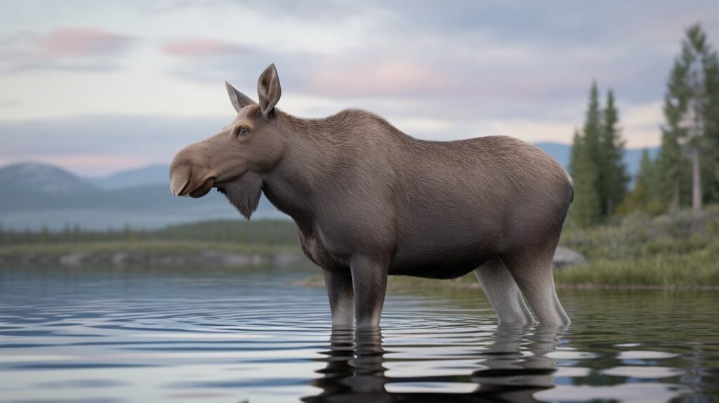
The Canadian Shield is home to diverse wildlife that has adapted to its unique environment. Large mammals include moose, caribou, black bears, and wolves, all of which thrive in the region’s forests and tundra. For kids interested in animals, the Shield provides habitat for over 200 bird species, including loons, eagles, and various waterfowl that migrate through the region seasonally. The countless lakes and rivers support healthy populations of fish like walleye, northern pike, and lake trout, making the area popular for recreational fishing.
Smaller animals like beavers, otters, lynx, and foxes also inhabit the Canadian Shield, playing important roles in the ecosystem. Beavers, in particular, are ecosystem engineers, creating wetlands that benefit numerous other species. In winter, many animals have special adaptations for survival, including thick fur coats, hibernation behaviors, or migration to warmer areas. The region’s biodiversity makes it ecologically significant, and in 2026, conservation efforts focus on protecting habitats from development pressures and climate change impacts affecting species distributions across the Shield.
Natural Resources and Minerals
The Canadian Shield is incredibly rich in natural resources, containing vast deposits of valuable minerals and metals. This region produces significant amounts of gold, silver, copper, nickel, iron ore, and zinc, making it economically important to Canada and influencing trade with the United States. For kids learning about how we obtain everyday materials, the Shield demonstrates where many metals in our electronics, buildings, and vehicles originate. Major mining operations have operated in the region for over a century, with cities like Sudbury, Ontario, developing specifically around mining industries.
Beyond metals, the Canadian Shield contains other important resources including uranium, diamonds, and various industrial minerals. The region’s forests provide timber for construction and paper products, though logging must be carefully managed to protect ecosystems. Hydroelectric power is another crucial resource, with the region’s numerous rivers and elevation changes making it ideal for generating renewable electricity. In 2026, the Shield continues to be a focal point for resource development, with ongoing debates about balancing economic benefits with environmental protection and Indigenous rights. These interesting discussions about sustainable resource use are increasingly important as demand for minerals grows globally.
People and Culture of the Canadian Shield
Indigenous peoples have inhabited the Canadian Shield for thousands of years, developing rich cultures adapted to the region’s challenges and opportunities. Groups including the Cree, Ojibwe, Inuit, and many others established traditional territories across the Shield, with deep knowledge of the land, waters, and wildlife. For kids learning about North American history, understanding that these were thriving communities long before European contact provides important context. Traditional practices included hunting, fishing, gathering, and trading, with seasonal movements following animal migrations and resource availability.
Today, many Indigenous communities continue living on their traditional lands within the Canadian Shield, maintaining cultural practices while also participating in modern economies. The region’s population remains relatively sparse compared to southern Canada and the United States, with most people living in small towns and cities rather than large metropolitan areas. Major urban centers like Thunder Bay, Sudbury, and Quebec City sit on the Shield’s edges, serving as economic and cultural hubs. In 2026, there is growing recognition of Indigenous rights and knowledge, with collaborative management approaches increasingly shaping how resources are developed and protected across the region. This cultural landscape makes the Canadian Shield not just geologically interesting, but also rich in human history and contemporary significance.
Fun Things to Do in the Canadian Shield
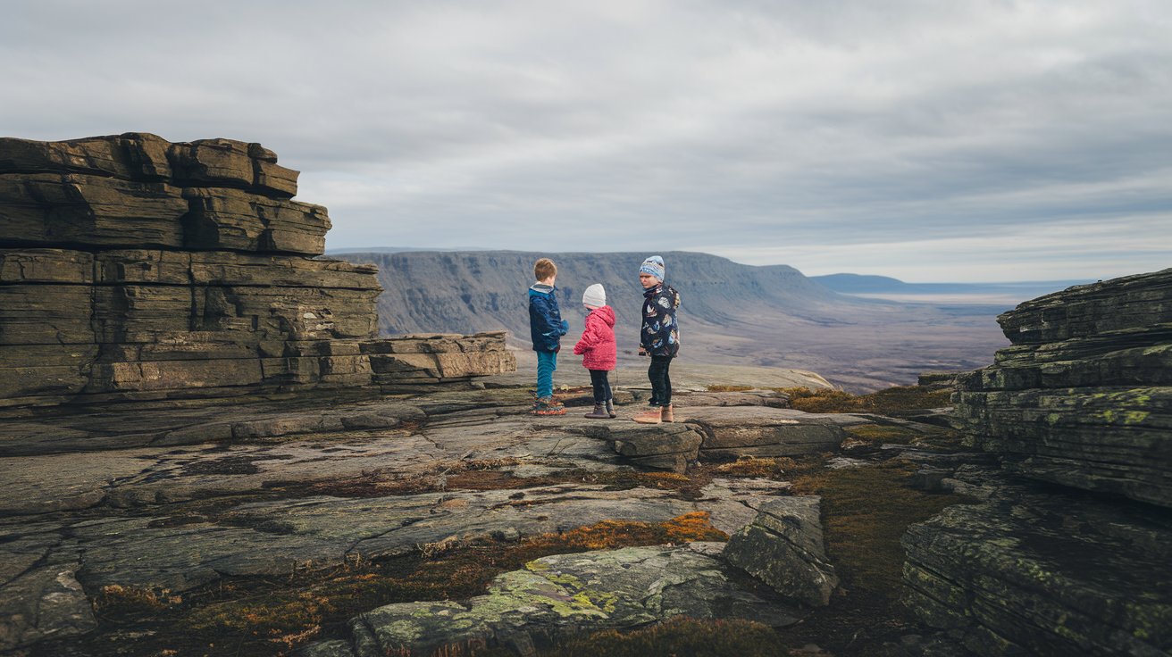
The Canadian Shield offers countless fun outdoor activities for families and young adventurers. Camping is extremely popular, with thousands of campsites located throughout the region’s provincial and national parks. For kids who enjoy water activities, canoeing and kayaking on the Shield’s pristine lakes and rivers provide unforgettable experiences, with routes ranging from beginner-friendly day trips to challenging multi-day expeditions. Many families visit during summer months when weather is warmest and days are longest, taking advantage of swimming, fishing, and wildlife watching opportunities.
Hiking trails throughout the Canadian Shield range from easy nature walks to challenging backcountry treks, offering opportunities to see ancient rock formations, waterfalls, and diverse ecosystems up close. Winter brings different fun activities including ice fishing, snowshoeing, cross-country skiing, and snowmobiling across frozen lakes and through snowy forests. For kids interested in geology, many areas offer rock collecting opportunities, though visitors should always follow local regulations about what can be taken. Educational programs at visitor centers teach about the region’s natural and cultural history, making learning interesting and hands-on. In 2026, sustainable tourism practices emphasize leaving no trace and respecting both natural environments and Indigenous territories when visiting the Shield.
Canadian Shield Map and Geography
A Canadian Shield map reveals the region’s distinctive horseshoe shape wrapping around Hudson Bay. The Shield extends from Labrador on the Atlantic coast, sweeps northwest through Quebec and Ontario, continues across northern Manitoba, Saskatchewan, Alberta, and the Northwest Territories, then curves back southeast through Nunavut. Portions also extend into the northern United States, including the Adirondack Mountains in New York, parts of the upper Midwest including northern Minnesota, Wisconsin, and Michigan’s Upper Peninsula.
For kids studying geography, understanding the Canadian Shield’s boundaries helps contextualize its massive size and regional variations. The southern edge roughly follows the Great Lakes-St. Lawrence River system, while the northern boundary transitions into Arctic tundra and eventually Arctic Ocean coastlines. Elevation varies across the region, though much of the Shield sits between 600-2,000 feet (180-600 meters) above sea level. Higher areas include the Torngat Mountains in Labrador reaching over 5,000 feet (1,500 meters) and various upland regions elsewhere. Using a map, kids can identify major features like Hudson Bay at the center, the countless blue dots representing lakes, and how the region relates to other North American geographical features they might recognize.
How Glaciers Shaped the Canadian Shield
Understanding how glaciers shaped the Canadian Shield is one of the most interesting geological lessons kids can learn. During the last ice age, which ended approximately 10,000 years ago, massive ice sheets up to 2 miles thick covered the entire Shield region. These glaciers were so heavy they actually pressed the Earth’s crust downward, and the land is still slowly rebounding upward today, a process called isostatic rebound. As glaciers moved, they acted like giant bulldozers, scraping away softer rocks and soil, leaving behind the hard ancient bedrock we see exposed today.
The glaciers carved out the basins that became the region’s millions of lakes and created the distinctive landscape of bare rock, thin soils, and scattered deposits called till. Striations, or scratch marks, visible on rock surfaces throughout the Canadian Shield show the direction glaciers moved, providing clues about ice age dynamics. For kids learning about Earth’s climate history, the Shield offers clear evidence of how dramatically our planet has changed. Glacial features like eskers (long ridges of sand and gravel), drumlins (elongated hills), and erratics (large boulders transported far from their origin) dot the landscape, creating the varied terrain visible on any detailed map of the region today in 2026.
Forests and Vegetation of the Shield
The Canadian Shield supports vast boreal forests, also called taiga, which represent one of Earth’s largest terrestrial biomes. These forests primarily consist of coniferous trees including black spruce, white spruce, jack pine, and balsam fir, adapted to the region’s cold climate and short growing season. For kids learning about plant adaptations, these trees have special features like needle-shaped leaves that reduce water loss and flexible branches that shed snow rather than breaking under its weight. Deciduous trees like birch, aspen, and poplar also grow in the Shield, particularly in southern areas and along waterways.
The forests provide crucial ecosystem services including carbon storage, oxygen production, and wildlife habitat. Understory vegetation includes shrubs like blueberry and Labrador tea, along with mosses, lichens, and various wildflowers that bloom during the brief but intense summer growing season. In northern areas of the Canadian Shield, trees gradually become smaller and more sparse, transitioning into tundra where only low-growing plants, mosses, and lichens survive. These vegetation patterns create the distinctive landscape that has supported both wildlife and human communities for millennia, and in 2026, forest management practices increasingly recognize the importance of protecting these ecosystems while sustainably harvesting timber resources that contribute to economies in both Canada and the United States.
Canadian Shield Printable Resources for Learning
Teachers and parents seeking Canadian Shield printable materials for educational activities have numerous options available in 2026. Outline maps showing the Shield’s boundaries help kids learn geography through coloring and labeling exercises. These printable resources often include space for students to mark major cities, lakes, rivers, and other geographical features, reinforcing spatial learning. Fact sheets summarizing key information about the region’s geology, climate, resources, and wildlife provide quick reference materials for reports and projects.
Activity worksheets might include crossword puzzles using vocabulary terms related to the Canadian Shield, matching exercises connecting animals to their adaptations, or fill-in-the-blank answers testing comprehension of facts learned. For younger kids, coloring pages featuring Shield wildlife like moose, loons, or beavers make learning fun and engaging. Older students might use printable graphic organizers to compare the Canadian Shield to other geographical regions or to chart how glaciers shaped the landscape. Many educational websites offer free downloadable materials, while others provide premium content with more detailed information and higher quality graphics. These printable resources support various learning styles and can be adapted for different grade levels, making the Canadian Shield accessible and interesting to study for kids across the United States learning about North American geography.
Related video about canadian shield for kids
This video complements the article information with a practical visual demonstration.
FAQ – Common Questions
What are some facts about the Canadian Shield for kids?
The Canadian Shield is a massive horseshoe-shaped region of ancient rock covering nearly half of Canada’s land area, with rocks dating back 2.5 to 4.3 billion years, making them some of Earth’s oldest. The region contains millions of lakes created by glaciers during ice ages and is rich in natural resources including gold, silver, copper, and nickel. It experiences extreme climate variations with cold winters often below -20°F and mild summers. The Shield supports boreal forests and diverse wildlife including moose, caribou, black bears, and over 200 bird species. Indigenous peoples have lived in this region for thousands of years, developing cultures adapted to its unique environment.
What is the Canadian Shield in simple words?
In simple words, the Canadian Shield is a huge area of very old, exposed rock that forms the geological foundation of North America. Think of it as Earth’s ancient basement floor showing through the surface, covering about 1.9 million square miles. The region got its name because its horseshoe shape looks like a warrior’s shield wrapping around Hudson Bay. It features mostly flat or gently rolling rocky terrain covered with thousands of lakes, rivers, and forests. The rocks here are billions of years old and were shaped by massive glaciers that scraped across the land during ice ages, creating the distinctive landscape we see today.
What are some fun things to do in the Canadian Shield?
Fun activities in the Canadian Shield include camping at thousands of campsites in provincial and national parks, canoeing and kayaking on pristine lakes and rivers, and hiking trails ranging from easy nature walks to challenging backcountry treks. Summer offers swimming, fishing, and wildlife watching opportunities, while winter brings ice fishing, snowshoeing, cross-country skiing, and snowmobiling. Families can explore ancient rock formations and waterfalls, participate in educational programs at visitor centers, and enjoy rock collecting in designated areas. The region’s natural beauty and outdoor recreation opportunities make it perfect for adventurous families and young explorers interested in nature and geology.
What animals live in the Canadian Shield?
The Canadian Shield supports diverse wildlife including large mammals like moose, caribou, black bears, and wolves that thrive in the region’s forests and tundra. Over 200 bird species inhabit or migrate through the area, including loons, eagles, and various waterfowl. The countless lakes and rivers support fish populations like walleye, northern pike, and lake trout. Smaller animals include beavers, otters, lynx, foxes, and numerous rodent species. Many of these animals have special adaptations for surviving the harsh winters, including thick fur coats, hibernation behaviors, or seasonal migration patterns. This biodiversity makes the Shield ecologically important and fascinating for wildlife enthusiasts.
How did glaciers shape the Canadian Shield?
During the last ice age ending about 10,000 years ago, massive glaciers up to 2 miles thick covered the Canadian Shield, pressing down the Earth’s crust with their enormous weight. As these glaciers moved, they scraped away softer rocks and soil like giant bulldozers, leaving behind exposed ancient bedrock. The glaciers carved out basins that filled with water to become the region’s millions of lakes and created distinctive features like eskers, drumlins, and erratics. Scratch marks called striations visible on rock surfaces show glacier movement directions. The land is still slowly rebounding upward from the glaciers’ weight, a process that continues today in 2026.
Why is the Canadian Shield important?
The Canadian Shield is important for multiple reasons, including its geological significance as one of Earth’s oldest rock formations, providing crucial insights into our planet’s early history. It contains vast natural resources including valuable minerals like gold, nickel, and copper that support economies in Canada and influence trade with the United States. The region holds enormous freshwater reserves in its millions of lakes and rivers, providing drinking water and supporting ecosystems. Its boreal forests store significant carbon and produce oxygen. The Shield has cultural importance as traditional territory for Indigenous peoples and offers recreational opportunities that support tourism industries while preserving wilderness areas increasingly rare in our modern world.
| Key Aspect | Important Details | Educational Benefit |
|---|---|---|
| Geological Age | Rocks dating 2.5-4.3 billion years old, among Earth’s oldest exposed formations | Teaches kids about Earth’s early history and geological processes |
| Size and Location | 1.9 million square miles covering half of Canada, extending into northern US | Helps children understand massive geographical scale and North American geography |
| Water Resources | Over 2 million lakes and countless rivers formed by glacial action | Demonstrates importance of freshwater conservation and glacial impacts |
| Climate Conditions | Subarctic climate with temperatures from -20°F in winter to 70-80°F in summer | Illustrates how geography affects weather patterns and seasonal changes |
| Natural Resources | Rich deposits of gold, silver, copper, nickel, iron ore, and other minerals | Shows kids where everyday materials come from and resource management importance |
| Wildlife Diversity | Home to 200+ bird species, large mammals, fish, and adapted smaller animals | Teaches biodiversity, animal adaptations, and ecosystem interconnections |