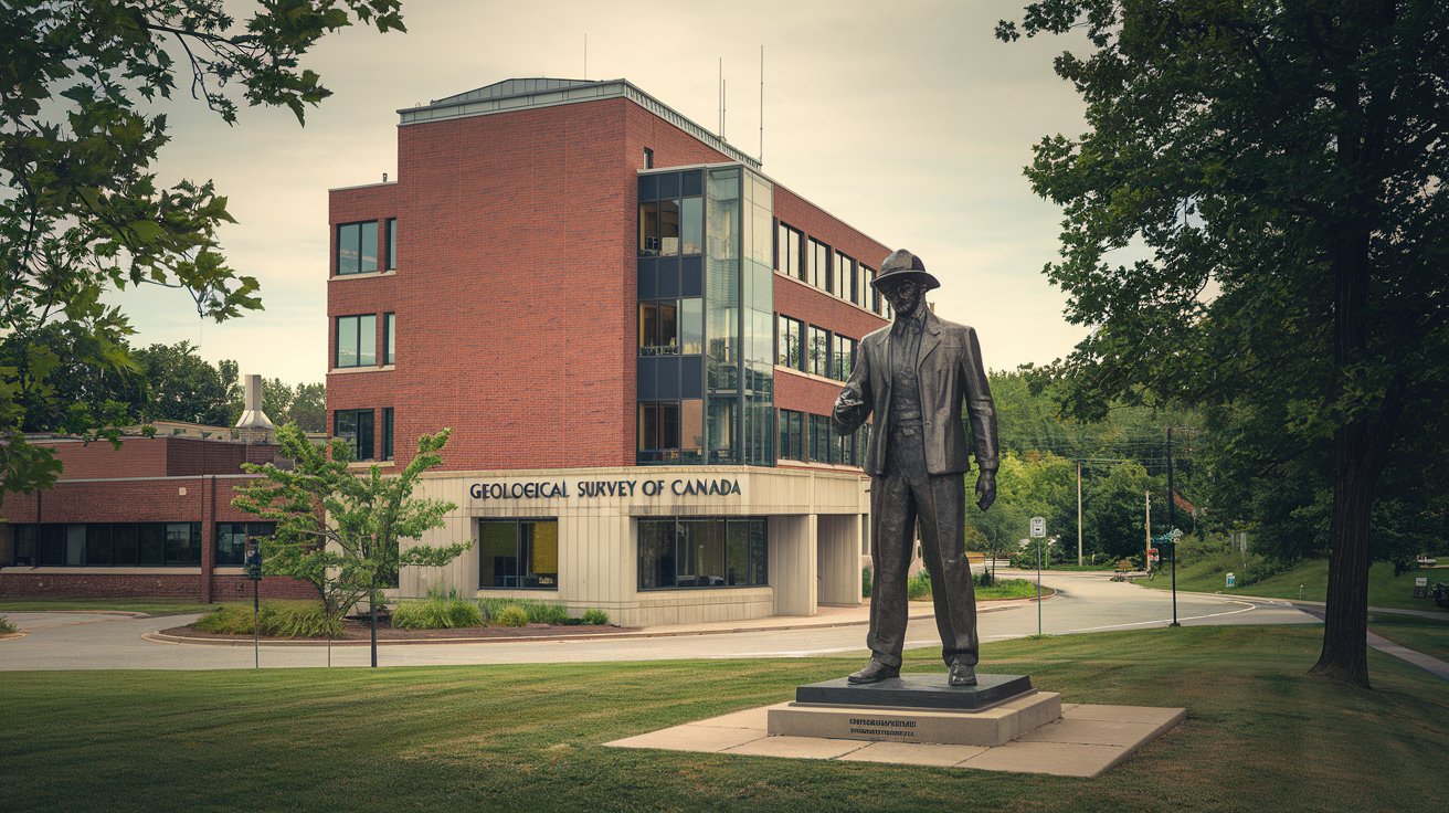
The Geological Survey of Canada (GSC) serves as the nation’s premier geoscience agency, providing essential research and data on Canada’s mineral resources, geological hazards, and environmental systems. Established in 1842, this organization offers invaluable resources for US geologists, researchers, and mining companies seeking cross-border collaboration and access to North American geoscience data. As of 2026, the GSC continues expanding its digital infrastructure and critical minerals initiatives, making Canadian geological information more accessible than ever for international partners.
What is the Geological Survey of Canada?
The Geological Survey of Canada represents one of North America’s oldest scientific organizations, founded in 1842 as a government agency dedicated to mapping and understanding Canada’s vast geological landscape. Operating under Natural Resources Canada (NRCan), the GSC employs over 450 scientists, researchers, and technical staff across multiple facilities in Ottawa, Calgary, Vancouver, Quebec City, and Dartmouth. The organization’s primary mission encompasses geological mapping, mineral resource assessment, hazard identification, and environmental geoscience research that extends across Canada’s 10 million square kilometers.
For US researchers and geologists, the GSC provides critical data sharing and collaborative opportunities, particularly regarding shared geological formations, mineral deposits, and hazards that cross international borders. The organization maintains extensive databases, publishes peer-reviewed research, and offers public access to geological maps, core samples, and geophysical surveys. In 2026, the GSC has prioritized digital transformation, making approximately 85% of its historical and contemporary geological data available through online portals accessible to international researchers and industry professionals.
Critical Minerals and Resource Assessment
The Critical Minerals Geoscience and Data Initiative represents the GSC’s flagship program for 2024-2026, with a budget allocation of CAD $47 million focused on identifying and characterizing deposits of lithium, cobalt, nickel, rare earth elements, and other materials essential for clean energy technologies. This initiative directly impacts US mineral exploration companies and battery manufacturers seeking to diversify North American supply chains away from foreign dependencies. The GSC has identified 127 new prospective zones for critical minerals across Canada, with detailed geological assessments available through their online geoscience portal.
US companies partnering with Canadian operations benefit from the GSC’s comprehensive mineral resource databases, which include over 240,000 documented mineral occurrences, geochemical analyses from 5.8 million sample locations, and high-resolution airborne geophysical surveys covering 8.2 million square kilometers. The organization’s geological mapping programs utilize modern LiDAR technology, hyperspectral imaging, and machine learning algorithms to identify mineral signatures, achieving detection accuracies exceeding 89% for specific deposit types in 2026 field validations.
Geoscience for the North Program
The Geoscience for the North initiative addresses the unique geological challenges and opportunities presented by Canada’s Arctic and subarctic regions, representing approximately 40% of the country’s landmass. This program focuses on understanding permafrost dynamics, ice-related hazards, northern mineral potential, and climate change impacts on geological systems. For US Arctic researchers and companies operating in Alaska, this program provides comparative data on similar geological environments, permafrost behavior models, and infrastructure engineering solutions applicable to northern development projects.
In 2026, the program expanded its collaboration with US Geological Survey (USGS) counterparts, establishing joint research protocols for circumpolar geological mapping and shared databases for Arctic mineral resources. The GSC has documented over 340 distinct geological formations across Canada’s northern territories, including previously unmapped regions in Nunavut and the Northwest Territories. These geological surveys reveal significant potential for diamond deposits, base metals, and rare earth elements, with preliminary economic assessments suggesting viable deposits in 23 newly characterized locations accessible to experienced Arctic mining operations.
Climate Change and Environmental Geoscience
The GSC’s climate change research programs investigate how geological processes interact with atmospheric and oceanic systems, providing essential baseline data for environmental monitoring and prediction models. Their 2026 research portfolio includes studies on carbon sequestration in geological formations, methane release from permafrost, coastal erosion rates, and sea-level rise impacts on populated areas. For US environmental scientists, these datasets offer comparative information for North American climate modeling, particularly regarding shared geological features like the Great Lakes basin, Appalachian formations, and Pacific coastal zones.
Recent GSC publications document accelerated permafrost thaw rates in northern Canada, with measurements showing 2.3 to 4.7 meters of active layer deepening since 2015 in specific monitoring sites. These findings have direct implications for infrastructure planning in Alaska and northern tier US states. The organization maintains 178 long-term geological monitoring stations that track subsidence, seismic activity, groundwater chemistry, and surface deformation, with data updated quarterly and available through their public geoscience data repository.
Marine and Coastal Geology Research
The GSC’s marine geoscience division conducts extensive research across Canada’s three ocean coastlines, totaling over 240,000 kilometers of shoreline including the Atlantic, Pacific, and Arctic oceans. This research encompasses seafloor mapping, submarine landslide hazards, offshore mineral resources, and coastal erosion processes. US researchers studying Pacific Northwest geology, Atlantic continental shelf dynamics, or Arctic Ocean development benefit from the GSC’s comprehensive bathymetric surveys and sediment core libraries containing over 35,000 catalogued samples from Canadian waters.
In 2026, the GSC completed high-resolution multibeam sonar mapping of 420,000 square kilometers of Canadian continental shelf, identifying 67 previously unknown submarine geological features and potential geohazard zones. Their coastal vulnerability assessments utilize advanced modeling combining geological substrate data, wave dynamics, and climate projections to predict erosion rates with 76% accuracy validated against five-year monitoring periods. These methodologies have been adopted by several US coastal states for their own vulnerability planning initiatives.
Geological Hazards and Public Safety
The hazards research program at the GSC focuses on earthquakes, landslides, tsunamis, and volcanic activity, maintaining Canada’s national seismic monitoring network and geological hazard databases. For US emergency management agencies and infrastructure planners, particularly in the Pacific Northwest and Alaska, GSC earthquake research provides critical context for shared tectonic environments including the Cascadia Subduction Zone, which poses tsunami risks to both Canadian and US coastal communities.
The GSC operates 342 seismic monitoring stations across Canada, with real-time data sharing agreements with USGS and university research networks. Their landslide susceptibility maps cover high-risk regions using geological, topographic, and precipitation data, achieving predictive accuracies of 82% for rainfall-triggered events. The organization documented 1,247 significant landslides across Canada between 2020-2025, with detailed case studies available for engineering and planning professionals. These resources inform building codes, land use regulations, and emergency response protocols applicable to similar geological settings in mountainous US regions.
Groundwater and Aquifer Systems
The GSC’s groundwater geoscience programs investigate Canada’s subsurface water resources, aquifer characterization, and water-rock interactions affecting water quality and availability. With over 8.9 million Canadians relying on groundwater for domestic use, the organization maintains extensive hydrogeological databases covering bedrock aquifers, glacial sediment systems, and fractured rock water sources. US water resource managers utilize GSC research on transboundary aquifer systems, particularly in the Prairie Provinces and Great Lakes region where geological formations extend across international borders.
Recent GSC studies have characterized 47 major aquifer systems across Canada, with detailed three-dimensional geological models available for 23 high-priority regions. Their research on aquifer vulnerability incorporates geological permeability data, land use patterns, and contaminant transport modeling, providing frameworks adopted by several US state geological surveys. The organization’s 2026 groundwater monitoring network includes 892 observation wells with continuous data logging, tracking water levels, temperature, and chemistry parameters that reveal long-term trends in aquifer health and recharge dynamics.
Energy Resources and Geological Storage
The GSC conducts comprehensive research on conventional and unconventional energy resources, including petroleum systems, natural gas hydrates, geothermal potential, and geological carbon storage opportunities. Their Western Canada Sedimentary Basin studies provide essential context for US operators in Montana, North Dakota, and other regions sharing geological formations with Alberta and Saskatchewan. The organization’s expertise in sedimentary geology, basin analysis, and hydrocarbon generation modeling supports both industry exploration and regulatory decision-making.
In 2026, the GSC published detailed assessments of Canada’s geothermal energy potential, identifying 89 prospective regions with subsurface temperatures exceeding 150°C at economically viable depths. Their carbon capture and storage (CCS) research has characterized over 2,400 gigatonnes of potential CO2 storage capacity in deep saline aquifers and depleted hydrocarbon reservoirs. These geological storage assessments utilize advanced reservoir modeling, caprock integrity analysis, and long-term monitoring protocols that inform similar projects in the United States. The GSC maintains publicly accessible databases of drill core, well logs, and seismic data covering sedimentary basins, with over 180,000 wells documented in their information systems.
Canadian Digital Core Library Initiative
The Canadian Digital Core Library represents a transformative initiative to digitally preserve and provide access to Canada’s physical core sample collections, which include over 2.8 million meters of drill core stored in provincial and federal facilities. This program utilizes high-resolution photography, CT scanning, and hyperspectral imaging to create digital twins of physical samples, making them accessible to researchers worldwide without requiring physical core shipping. US geologists and exploration companies can access these digital resources through the GSC’s online portal, examining core samples from historical exploration programs and research projects.
As of 2026, the initiative has digitized approximately 340,000 meters of core from priority mineral districts and sedimentary basins, with machine learning algorithms automatically identifying geological features, mineral content, and structural characteristics. The digital core library integrates with assay databases, providing users with both visual data and geochemical analyses from the same sample intervals. This resource has proven particularly valuable for reconnaissance exploration, academic research, and machine learning training datasets for automated geological interpretation systems. The GSC plans to complete digitization of all publicly accessible core holdings by 2028, creating the world’s largest open-access digital core repository.
Geological Survey of Canada Maps and Publications
The GSC produces and distributes an extensive range of geological maps, scientific publications, and technical reports covering all aspects of Canadian geoscience. Their mapping programs operate at multiple scales, from 1:50,000 bedrock geology maps providing detailed local information to 1:5,000,000 national compilations showing major geological provinces and structures. For US researchers, these maps provide essential context for understanding North American geological evolution, mineral belts that extend across borders, and regional geophysical signatures.
The organization’s online map portal provides free access to over 12,000 published maps, including surficial geology, bedrock geology, geophysical compilations, and thematic maps covering specific resources or hazards. In 2026, the GSC completed a comprehensive digital upgrade of their publication repository, making approximately 89,000 technical documents fully searchable and downloadable. Their peer-reviewed journal publications appear in leading geoscience venues, with GSC scientists authoring over 340 papers in 2025 covering topics from Archean crustal evolution to modern permafrost dynamics. The organization maintains comprehensive bibliographic databases allowing users to search for publications by region, commodity, geological age, or research topic.
Geological Survey of Canada Job Opportunities
The GSC regularly posts employment opportunities for geologists, geophysicists, geochemists, GIS specialists, and technical support staff across their facilities in Ottawa, Calgary, Vancouver, Quebec City, and Dartmouth. US citizens with relevant qualifications can apply for GSC positions, though most positions require Canadian work authorization. The organization particularly seeks expertise in critical minerals exploration, digital geoscience, hazard assessment, and environmental geochemistry, offering competitive compensation packages within the Canadian federal public service salary structure.
As of 2026, geologist positions at the GSC typically fall within the Canadian federal Research Scientist (RES) classification, with starting salaries ranging from CAD 71,000 to CAD 94,000 depending on experience and credentials, while senior research scientists earn between CAD 95,000 and CAD 135,000. The organization offers comprehensive benefits including pension contributions, professional development funding, and opportunities for international collaboration. US geologists interested in GSC careers benefit from the organization’s focus on cutting-edge geoscience technology, access to world-class analytical facilities, and involvement in projects spanning Canada’s diverse geological environments from Arctic islands to deep ocean settings.
Accessing GSC Resources from the United States
US researchers, companies, and government agencies can access GSC resources through multiple channels, including their main website (geoscan.nrcan.gc.ca), the GEOSCAN publication database, and specialized portals for geophysical data, geochemical surveys, and paleontological collections. Most GSC data and publications are available without charge under open government data policies, though some specialized datasets or analytical services may require collaborative agreements or fee-for-service arrangements. The organization maintains reciprocal data sharing agreements with USGS and several US state geological surveys.
The Geological Survey of Canada address for the main Ottawa facility is 601 Booth Street, Ottawa, Ontario K1A 0E8, Canada, while the Calgary office operates from 3303 33rd Street NW, Calgary, Alberta T2L 2A7. US visitors to GSC facilities typically require appointments scheduled through program managers or research scientists. For virtual collaboration, the GSC utilizes standard communication platforms and maintains extensive online resources including webinar series, virtual core libraries, and interactive mapping applications compatible with US IT systems. The organization actively participates in North American geological conferences and maintains collaborative research projects with over 40 US universities and research institutions as of 2026.
Related video about geological survey of canada
This video complements the article information with a practical visual demonstration.
FAQ – Common Questions
What is the salary of a geologist working for the Geological Survey of Canada?
Geologists at the Geological Survey of Canada earn salaries based on the federal Research Scientist (RES) classification system. As of 2026, entry-level research scientists with master’s degrees typically start between CAD 71,000 and CAD 84,000 annually, while experienced geologists with PhDs earn between CAD 85,000 and CAD 110,000. Senior research scientists and program managers can earn CAD 115,000 to CAD 135,000. These positions include comprehensive federal benefits, pension contributions averaging 15-17% of salary, professional development allowances, and opportunities for international fieldwork. Salaries are adjusted annually for cost of living and are competitive with private sector geological consulting positions in major Canadian cities.
What is the oldest rock found in Canada according to GSC research?
The oldest rock in Canada identified by Geological Survey of Canada researchers is the Acasta Gneiss, located in the Northwest Territories approximately 300 kilometers north of Yellowknife. Uranium-lead dating conducted by GSC scientists determined these metamorphic rocks formed approximately 4.03 billion years ago, making them among Earth’s oldest known crustal materials. The GSC also documented the Nuvvuagittuq Greenstone Belt in northern Quebec, with some components potentially dating to 4.28 billion years, though this dating remains under scientific debate. These ancient rocks provide crucial evidence about Earth’s early geological processes, crustal formation, and the conditions that existed during the Hadean and Eoarchean eons.
Is Canada the most mineral rich country based on GSC assessments?
While Canada ranks among the world’s top mineral-producing nations, GSC assessments indicate that determining the single “most mineral rich country” depends on specific criteria including diversity of minerals, reserve sizes, and economic viability. Canada leads globally in production of potash, uranium, and several critical minerals, and ranks in the top five for nickel, cobalt, diamonds, and rare earth elements. The GSC has documented over 240,000 mineral occurrences across Canada’s 10 million square kilometers, with significant undiscovered potential in northern and offshore regions. Countries like Australia, Russia, China, and the United States also possess enormous mineral wealth. Canada’s advantage lies in political stability, advanced geological mapping, transparent regulatory systems, and ongoing GSC research that continues identifying new prospective zones for mineral exploration.
How can US companies access Geological Survey of Canada mapping data?
US companies can access GSC mapping data through the organization’s open data portal at geoscan.nrcan.gc.ca and the Geoscience Data Repository. Most geological maps, geophysical surveys, and geochemical datasets are available for free download under Canada’s Open Government License, allowing commercial use without restrictions. Companies requiring specialized data processing, custom map compilations, or analytical services can establish collaborative agreements or fee-for-service contracts with the GSC. The organization maintains over 12,000 published maps in digital format, including bedrock geology, surficial deposits, mineral occurrence compilations, and geophysical interpretations. Data formats are compatible with standard GIS software including ArcGIS and QGIS. For proprietary exploration data or restricted datasets, companies must follow specific access protocols outlined on the GSC website.
What collaborative research opportunities exist between GSC and US institutions?
The Geological Survey of Canada maintains active collaborative research programs with US Geological Survey, numerous universities, and private research organizations. Collaboration mechanisms include joint research projects on transboundary geological features, shared monitoring networks for seismic and volcanic hazards, reciprocal data sharing agreements, and co-authored scientific publications. As of 2026, the GSC participates in 47 active international research projects involving US partners, covering topics from Arctic permafrost monitoring to critical minerals exploration techniques. US researchers can propose collaborations through formal mechanisms including Natural Resources Canada’s innovation programs, joint grant applications through organizations like NSF and NSERC, or direct contact with GSC research scientists. The organization particularly welcomes collaborations addressing shared geological challenges affecting both nations, including earthquake hazards in the Pacific Northwest, Great Lakes geology, and Arctic resource assessment.
Where are the main Geological Survey of Canada office locations?
The Geological Survey of Canada operates five main facilities across the country. The national headquarters is located at 601 Booth Street in Ottawa, Ontario, housing the largest concentration of research staff and the national geological collections. The Calgary office at 3303 33rd Street NW focuses on energy resources and sedimentary basin research. The Vancouver office on West Pender Street specializes in Pacific geoscience and marine geology. Additional facilities operate in Quebec City (focused on Quebec and Appalachian geology) and Dartmouth, Nova Scotia (emphasizing Atlantic offshore and coastal research). Each facility maintains specialized laboratories, core storage facilities, and research equipment. US visitors can arrange facility tours and research consultations by contacting specific program managers, though advance scheduling is required for access to secured research areas and sample collections.
| GSC Program Area | Key Resources Available | Benefits for US Users |
|---|---|---|
| Critical Minerals Research | 240,000+ mineral occurrences, geochemical data from 5.8M samples, prospectivity maps | Supply chain diversification, exploration targeting, comparative geology |
| Geological Mapping | 12,000+ published maps, digital bedrock and surficial geology, geophysical compilations | Cross-border geological understanding, regional context, exploration planning |
| Hazards Research | 342 seismic stations, landslide databases, tsunami modeling, permafrost monitoring | Shared hazard assessment for Cascadia, Alaska, emergency planning protocols |
| Digital Core Library | 340,000+ meters digitized core, hyperspectral imaging, integrated assay data | Remote core examination, machine learning training data, historical exploration insights |
| Publications Repository | 89,000 technical documents, peer-reviewed research, open access databases | Scientific literature, methodology development, case study examples |
| Groundwater Systems | 47 aquifer characterizations, 892 monitoring wells, transboundary aquifer studies | Water resource management, aquifer vulnerability assessment, contamination modeling |