A geophysical survey uses non-invasive physical measurements to investigate subsurface conditions without excavation. These surveys detect variations in Earth’s physical properties like density, magnetism, electrical conductivity, and seismic velocity to locate groundwater, minerals, archaeological features, and assess geological hazards. In the United States, geophysical survey methods have become essential across industries from environmental consulting to infrastructure development, with applications ranging from mapping aquifers to identifying mineral deposits worth billions in economic value.
What Is a Geophysical Survey
A geophysical survey systematically measures physical properties of the subsurface to create detailed maps of geological structures, material properties, and anomalies. Unlike traditional drilling methods that provide data at specific points, geophysical surveys offer continuous coverage across large areas, making them cost-effective for initial site characterization. These surveys apply principles from physics to detect contrasts in rock and soil properties without physical disturbance to the ground.
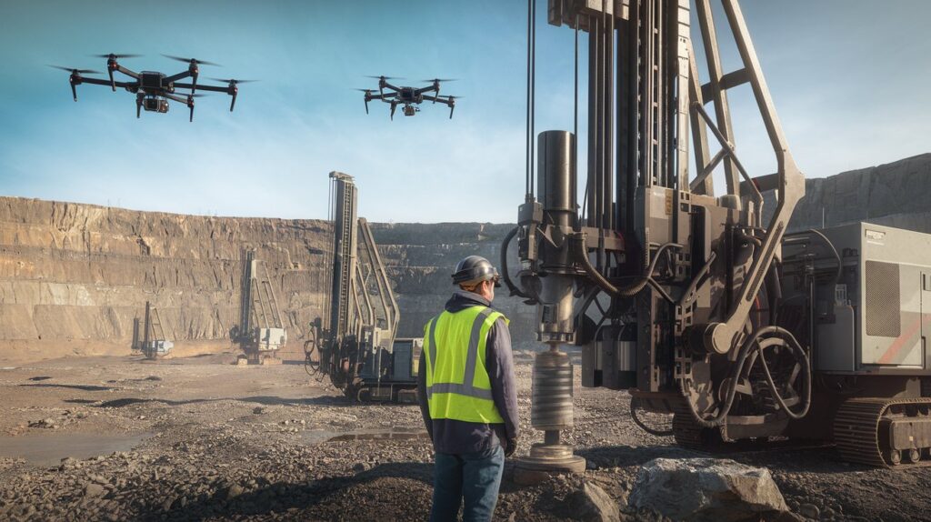
The fundamental principle behind all geophysical survey methods involves sending energy into the ground and measuring the response. Different materials respond uniquely to various energy types—magnetic fields, electrical currents, seismic waves, or gravitational forces. In 2026, advanced geophysical survey equipment includes drone-mounted magnetometers, autonomous ground-penetrating radar systems, and AI-enhanced data processing software that delivers results within hours rather than weeks.
Modern geophysical surveys in the United States serve multiple sectors including environmental remediation, mineral exploration, archaeological investigation, geotechnical engineering, and groundwater management. The US Geological Survey reports that over 15,000 geophysical surveys are conducted annually across federal lands alone, with private sector applications numbering significantly higher. These surveys reduce exploration costs by 40-60% compared to traditional drilling-only approaches while providing comprehensive subsurface understanding.
Most Common Geophysical Survey Methods
Understanding the various geophysical survey methods helps determine the most appropriate technique for specific subsurface objectives. Each method exploits different physical properties and offers unique advantages depending on target depth, resolution requirements, and site conditions. Selection of the proper geophysical survey technique directly impacts project success and budget efficiency.
Magnetic Surveys for Mineral Exploration
Magnetic surveys measure variations in Earth’s magnetic field caused by buried magnetic minerals like magnetite and pyrrhotite. This geophysical survey method is particularly effective for mineral exploration since many valuable ore deposits contain magnetic minerals or alter surrounding rocks magnetically. In the United States, magnetic surveys have contributed to discovering major deposits in Minnesota’s Iron Range and copper-nickel deposits in northern Michigan, with exploration budgets for magnetic surveys averaging $50,000-$200,000 per project in 2026.
Modern magnetic survey equipment includes high-sensitivity cesium vapor magnetometers and optically pumped magnetometers that detect variations as small as 0.01 nanoTesla. Drone-mounted systems can survey 50-100 square kilometers daily, providing unprecedented efficiency. The data reveals geological structures, fault zones, and intrusive bodies that may host mineralization. Processing techniques like reduction-to-pole and analytic signal analysis extract maximum geological information from magnetic data collected during these surveys.
Electromagnetic Surveys for Conductivity Mapping
Electromagnetic surveys measure subsurface electrical conductivity by inducing electrical currents with varying frequency electromagnetic fields. This geophysical survey approach excels at detecting conductive features like groundwater, clay layers, mineralized zones, and buried metallic objects. Time-domain electromagnetic (TEM) and frequency-domain electromagnetic (FEM) systems dominate the market, with costs ranging from $75-$300 per line-kilometer depending on survey specifications and terrain accessibility in 2026.
Applications of electromagnetic surveys in the United States include mapping saltwater intrusion in coastal aquifers, delineating clay caps over waste disposal sites, and exploring for massive sulfide deposits. The USGS utilizes helicopter-borne electromagnetic systems to map aquifer systems across western states where groundwater resources face increasing demand. Modern geophysical survey equipment for electromagnetic work provides penetration depths from 10 meters for shallow environmental investigations to 500+ meters for deep mineral exploration targets.
Electrical Resistivity Surveys for Groundwater
Electrical resistivity surveys inject direct current into the ground through electrodes and measure resulting voltage differences to calculate subsurface resistivity distribution. This geophysical survey for groundwater applications remains the gold standard because water-saturated formations exhibit significantly lower resistivity than dry rocks. Survey configurations like Wenner, Schlumberger, and dipole-dipole arrays provide different depth penetrations and resolutions suited to specific hydrogeological questions.
A typical geophysical survey for borehole drilling site selection uses electrical resistivity tomography (ERT) to image subsurface in two or three dimensions before expensive drilling begins. In 2026, automated multi-electrode resistivity systems with 128+ channels collect data 10 times faster than traditional methods, with project costs averaging $3,000-$15,000 depending on line length and terrain. Success rates for water well drilling improve by 70% when preceded by properly executed electrical resistivity surveys, according to National Ground Water Association data.
Seismic Surveys for Subsurface Imaging
Seismic surveys use controlled energy sources to generate elastic waves that travel through the subsurface, reflecting and refracting at geological boundaries. Geophones or accelerometers record these waves, and sophisticated processing creates detailed images of subsurface structure. This geophysical survey method provides the highest resolution images of geological layering and is essential for oil and gas exploration, although environmental and engineering applications increasingly utilize shallow seismic techniques in 2026.
Reflection seismology dominates petroleum exploration with 3D surveys covering hundreds of square kilometers, while refraction seismology maps bedrock depth and rippability for construction projects. Surface wave methods (MASW) characterize near-surface shear wave velocity for seismic hazard assessment. The United States conducts over 5,000 seismic surveys annually for various purposes, with geophysical survey equipment ranging from simple sledgehammer sources for shallow work to vibroseis trucks for deep exploration. Environmental seismic surveys typically cost $150-$500 per line-kilometer, while offshore seismic operations exceed $100,000 daily.
Ground Penetrating Radar Technology
Ground Penetrating Radar (GPR) transmits high-frequency electromagnetic pulses into the ground and records reflections from subsurface interfaces and objects. This geophysical survey technique excels in shallow investigations up to 15 meters depth, providing extremely high resolution images of utilities, voids, archaeological features, and soil stratigraphy. GPR frequencies range from 25 MHz for maximum depth to 2.5 GHz for centimeter-scale resolution of concrete structures.
Modern GPR survey equipment includes multi-channel array systems that collect 3D data while walking or driving across sites, with real-time visualization on tablet computers. Applications span utility location before excavation, pavement thickness assessment, tunnel inspection, and forensic investigations. The technology performs poorly in conductive materials like clay-rich soils or saltwater environments. In the United States construction sector, GPR surveys prevent an estimated $500 million in utility damages annually, with typical survey costs of $1,500-$5,000 per day depending on site complexity and equipment specifications in 2026.
Geophysical Survey vs Geological Survey
The difference between a geophysical survey and a geological survey centers on methodology and data collection approaches. A geological survey involves direct observation and sampling of rocks, minerals, and geological structures through field mapping, rock sampling, and laboratory analysis of physical specimens. Geologists examine outcrops, collect samples, and create maps based on surface observations and limited subsurface data from boreholes or excavations.
In contrast, a geophysical survey measures physical properties remotely without direct contact with target materials, providing continuous data coverage across areas where geological observation is impossible. While geological surveys deliver definitive rock identification and detailed mineralogical information at specific locations, geophysical surveys reveal subsurface structure and property distributions across broad areas efficiently. The optimal exploration strategy combines both approaches—geophysics identifies targets and maps continuity while geology provides ground truth validation and detailed characterization.
Cost and coverage differ dramatically between these survey types. A geological survey mapping 100 square kilometers might require months of fieldwork and cost $200,000-$500,000, while a magnetic or electromagnetic geophysical survey covers the same area in weeks for $50,000-$150,000. However, geophysical survey results require geological interpretation and often subsequent geological sampling for definitive confirmation. Modern mineral exploration projects in the United States typically allocate 30-40% of budgets to geophysics and 60-70% to geology and drilling in integrated programs.
Geophysical Survey vs Geotechnical Survey
Understanding the difference between a geophysical survey and a geotechnical survey is crucial for infrastructure and construction projects. A geotechnical survey focuses on determining engineering properties of soils and rocks through invasive testing methods including drill holes, test pits, in-situ testing, and laboratory analysis of samples. Geotechnical engineers measure parameters like bearing capacity, shear strength, consolidation characteristics, and permeability to design foundations, slopes, and earthworks.
Geophysical surveys complement geotechnical investigations by providing continuous subsurface profiles between discrete borehole locations, identifying subsurface anomalies, and optimizing borehole placement. Seismic refraction determines rippability and rock quality, electrical resistivity maps moisture content and soil layering, while GPR locates voids and buried obstructions. The American Society of Civil Engineers recommends integrating geophysical methods into geotechnical programs to reduce investigation costs by 20-35% while improving site characterization quality.
A comprehensive site investigation for a major infrastructure project in 2026 might include $150,000 in geophysical surveys followed by $400,000 in targeted geotechnical drilling and testing. The geophysical survey data guides borehole placement, reducing unnecessary drilling while ensuring critical features are adequately sampled. This integrated approach has become standard practice for highway projects, dam construction, and large building foundations across the United States, with federal agencies requiring geophysical assessments for projects exceeding $10 million in value.
How Much Does a Geophysical Survey Cost
The cost of a geophysical survey varies dramatically based on method, survey area, terrain accessibility, and data processing requirements. In 2026, basic GPR utility location surveys start at $1,500-$3,000 for small sites, while comprehensive multi-method environmental site characterizations range from $25,000-$100,000. Large-scale mineral exploration programs employing airborne magnetics and electromagnetics over hundreds of square kilometers exceed $500,000 for complete data acquisition and interpretation.
Key factors affecting geophysical survey cost include mobilization expenses, daily equipment and crew rates, line-kilometer pricing, and deliverable complexity. Ground-based magnetic surveys typically cost $75-$150 per line-kilometer, electrical resistivity $150-$300 per line-kilometer, and seismic reflection $300-$600 per line-kilometer. Helicopter-borne surveys achieve economies of scale at $50-$100 per line-kilometer over large blocks despite high mobilization costs. Processing and interpretation add 30-50% to field acquisition costs for basic reporting or 100-200% for advanced modeling and integration.
Offshore geophysical surveys represent the highest cost category, with vessel day rates of $50,000-$200,000 depending on equipment sophistication. A typical offshore wind farm site characterization requires $2-5 million in combined geophysical and geotechnical investigation. Conversely, small environmental or archaeological surveys with single-day field efforts and basic reporting run $5,000-$15,000. United States geophysical survey companies generally require minimum project fees of $3,000-$5,000 to cover mobilization and reporting regardless of survey size.
Geophysical Survey Equipment and Technology
Modern geophysical survey equipment has evolved dramatically with advances in electronics, computing power, and sensor technology. Magnetometers have progressed from proton precession instruments requiring frequent readings to continuous-recording optically-pumped systems achieving 0.001 nanoTesla sensitivity. Electrical resistivity systems expanded from 4-electrode manual configurations to 128+ channel automated arrays collecting thousands of measurements hourly. GPS integration provides centimeter-level positioning accuracy essential for repeat surveys and data integration.
Autonomous and remotely-operated platforms revolutionize data collection efficiency in 2026. Drone-mounted magnetometers and GPR systems survey difficult terrain without ground access, underwater remotely operated vehicles (ROVs) conduct offshore geophysical surveys, and autonomous surface vessels map shallow water environments. Distributed acoustic sensing (DAS) using fiber-optic cables transforms seismic acquisition with thousands of virtual receivers along single cables. These technological advances reduce field time by 50-70% while improving data quality and safety in hazardous environments.
Cloud-based processing and machine learning algorithms have transformed data interpretation workflows. Real-time quality control during acquisition prevents costly resurveys, automated processing applies best-practice algorithms consistently, and AI-assisted interpretation identifies anomalies and patterns humans might miss. Geophysical survey companies in the United States increasingly offer cloud-delivered results with interactive visualization allowing clients to explore data through web browsers without specialized software. Equipment investment for a full-service geophysical survey company ranges from $500,000 for basic capabilities to $5+ million for comprehensive multi-method offshore and airborne systems.
Applications of Geophysical Surveys
The versatility of geophysical survey methods supports diverse applications across environmental, engineering, resource exploration, and scientific domains. Each application exploits specific physical property contrasts to address particular subsurface questions with varying depth ranges, resolutions, and accuracy requirements.
Geophysical Survey for Groundwater Exploration
Geophysical survey for groundwater applications focuses on mapping aquifer geometry, identifying recharge and discharge zones, and locating productive drilling targets. Electrical resistivity and electromagnetic methods detect water-saturated formations through their high conductivity, while seismic refraction delineates bedrock aquifers. Gravity surveys map basin geometry controlling regional groundwater flow in sedimentary aquifers across western United States.
Success in groundwater exploration requires integrating multiple geophysical methods with hydrogeological understanding. A typical program combines reconnaissance-scale EM or resistivity profiling to identify prospective zones, followed by detailed resistivity tomography at selected drilling sites. In arid regions where water resources are critical, geophysical surveys increase successful well completion rates from 60% to over 85% while reducing average drilling depths by 20-30%. The USGS estimates that proper geophysical survey for borehole drilling site selection saves $15,000-$30,000 per well in avoided dry holes and reduced drilling depth across the United States annually.
Geophysical Survey for Mineral Exploration
Geophysical survey for mineral exploration seeks anomalies indicating ore deposits through contrasts in magnetic susceptibility, electrical conductivity, density, or induced polarization. Different deposit types require specific geophysical approaches—magnetic surveys for iron and nickel, electromagnetic for massive sulfides, gravity for chromite and kimberlite, and IP for disseminated copper and gold. Modern mineral exploration in the United States routinely employs airborne magnetics and electromagnetics for regional-scale targeting followed by ground-based surveys to refine drill targets.
The economic impact of successful mineral exploration drives substantial investment in geophysics. Discovery of a major copper deposit generates billions in economic value, justifying exploration budgets of $5-20 million over multi-year programs. Resolution Mine in Arizona, currently under development with 1.6 billion tons of ore, was initially identified through integrated magnetic and gravity surveys in the 1990s. In 2026, junior exploration companies allocate 40-60% of exploration budgets to geophysical surveys before expensive drilling, while major producers maintain in-house geophysical departments with $10+ million annual equipment and operational budgets.
Environmental Site Assessment Applications
Environmental geophysical surveys characterize contaminated sites, map landfill boundaries, detect underground storage tanks, and monitor remediation effectiveness non-invasively. Electrical resistivity tracks contaminant plumes through conductivity anomalies, GPR locates buried drums and excavation limits, electromagnetic methods map landfill extent, and microgravity detects subsurface voids from mining or dissolution. The US Environmental Protection Agency has published technical protocols for geophysical methods at Superfund sites, recognizing their value in reducing investigation costs and accelerating cleanup.
Regulatory drivers and liability concerns make environmental geophysical surveys routine for property transactions and development projects. Phase II Environmental Site Assessments increasingly incorporate geophysics to optimize soil boring locations, with costs of $15,000-$40,000 for comprehensive surveys significantly less than the $100,000-$300,000 for traditional drilling-intensive investigations. Time-lapse resistivity monitoring of remediation systems provides real-time feedback on treatment effectiveness, allowing adaptive management that reduces cleanup timeframes by 20-40%. The US environmental geophysics market exceeded $450 million in 2026, growing at 8% annually as sustainability concerns drive thorough site characterization.
Geophysical Survey Accuracy and Limitations
Understanding how accurate geophysical surveys are requires recognizing that these methods provide indirect measurements of subsurface properties rather than direct observations. Accuracy depends on physical property contrasts, survey design quality, equipment precision, data processing methodology, and interpretation expertise. Well-executed surveys locate targets within 5-10% of predicted position and depth, while poorly designed efforts may miss targets entirely or generate misleading results.
The principle of equivalence represents a fundamental limitation where different subsurface configurations produce identical geophysical responses. A thin conductive layer may appear identical to a thick moderately-conductive layer in electrical resistivity data. Resolution limits prevent distinguishing features smaller than roughly one-third the depth of investigation. Environmental noise from powerlines, cultural metal objects, and temporal variations degrade data quality. These limitations necessitate integrating multiple geophysical methods with complementary sensitivities and confirming interpretations with direct sampling through boreholes or test pits.
Quantitative accuracy assessment through forward modeling and inversion analysis has improved dramatically with computing advances. Modern processing software tests thousands of subsurface models to find configurations matching observed data within measurement uncertainty. Uncertainty analysis quantifies confidence levels, with typical depth determination accuracy of ±10-15% and lateral position accuracy of ±5-10% under favorable conditions. The Environmental and Engineering Geophysical Society publishes quality control standards requiring accuracy documentation for geophysical surveys, with leading practitioners achieving verified 90%+ target detection rates for properly designed surveys in the United States in 2026.
Selecting Geophysical Survey Companies
Choosing among geophysical survey companies requires evaluating technical capabilities, relevant experience, quality systems, and professional credentials. The United States market includes over 300 specialized firms ranging from single-person consultancies to international corporations with hundreds of employees. Professional registration through organizations like the Environmental and Engineering Geophysical Society, membership in the Society of Exploration Geophysicists, and state professional geophysics licensure indicate commitment to technical standards and ethical practice.
Critical evaluation factors include equipment inventory matching project requirements, demonstrated experience with similar applications, qualified interpretation staff with advanced degrees in geophysics or related fields, quality management systems following industry standards, and appropriate insurance coverage. Request example reports from comparable projects, verify references with previous clients, and confirm principals will personally oversee your project rather than delegating to junior staff. The lowest-cost provider frequently delivers inferior results requiring expensive resurveys, while established firms with premium pricing provide comprehensive services preventing costly oversights.
Project scope documentation should specify survey methods, line spacing and orientation, expected deliverables, processing procedures, interpretation approach, and schedule. Fixed-price contracts provide budget certainty for defined scopes, while time-and-materials arrangements offer flexibility for evolving projects. Typical contract values range from $10,000 for simple single-method surveys to $500,000+ for complex multi-method programs. Leading geophysical survey companies maintain $2-5 million professional liability insurance and participate in industry technical committees advancing best practices. In 2026, digital deliverables include raw data files, processed sections and maps, interpretation reports, and increasingly interactive 3D models viewable through web applications without specialized software requirements.
Future Trends in Geophysical Surveying
The evolution of geophysical survey technology and methodology continues accelerating with transformative innovations emerging in 2026. Quantum sensors utilizing atomic interference achieve magnetic field sensitivity 100 times greater than conventional magnetometers in compact packages suitable for drone deployment. Distributed fiber-optic sensing converts telecommunication cables into dense seismic arrays with thousands of channels at fraction of conventional costs. Satellite-based gravity gradiometry and synthetic aperture radar provide reconnaissance-scale data over entire continents, identifying prospects for detailed ground follow-up.
Artificial intelligence and machine learning revolutionize data interpretation by training algorithms on databases of previous surveys correlated with drilling results. Neural networks automatically identify drilling targets from geophysical data with accuracy matching experienced interpreters, while detecting subtle patterns humans overlook. Real-time processing during acquisition allows adaptive survey design, concentrating effort on anomalous zones while reducing line density over background areas. These advances increase information extraction while reducing field time and overall project costs by 30-50% compared to traditional approaches.
Regulatory and societal factors increasingly influence geophysical survey practice. Environmental permitting for ground-disturbing seismic sources has driven adoption of passive seismic and ambient noise methods requiring no active sources. Offshore wind development creates massive demand for marine geophysical surveys, with the US market projected to exceed $200 million annually by 2028. Critical mineral initiatives to reduce import dependence on rare earths and battery metals drive exploration investment with geophysics providing cost-effective initial targeting. The integration of geophysical data into digital twins for infrastructure monitoring, carbon sequestration site characterization, and geothermal resource assessment represents rapidly growing application areas positioning geophysics as essential to energy transition and climate change mitigation efforts.
Related video about geophysical survey
This video complements the article information with a practical visual demonstration.
FAQ – Common Questions
How much does a geophysical survey cost?
Geophysical survey costs range from $1,500-$3,000 for basic single-day GPR utility location to $500,000+ for comprehensive airborne mineral exploration programs. Typical environmental site characterizations cost $25,000-$100,000, while groundwater exploration surveys average $10,000-$30,000. Ground-based methods run $75-$600 per line-kilometer depending on technique, with electrical resistivity at $150-$300, magnetics at $75-$150, and seismic reflection at $300-$600 per line-kilometer. Offshore surveys with specialized vessels exceed $50,000 daily. Project complexity, terrain accessibility, survey area, and deliverable requirements significantly impact final costs in the United States in 2026.
What is the difference between a geophysical survey and a geological survey?
A geological survey involves direct observation, mapping, and sampling of rocks and minerals through field work and laboratory analysis, providing definitive identification at specific locations. A geophysical survey measures physical properties remotely using instruments without direct contact, revealing subsurface structure and property distributions across broad areas. Geological surveys deliver detailed mineralogical and compositional data but cover limited areas at high cost, while geophysical surveys provide continuous coverage efficiently but require interpretation and often geological validation. Optimal exploration strategies integrate both approaches, using geophysics for targeting and mapping continuity while geology provides ground truth validation. Cost and coverage differ dramatically, with geophysics covering 100 square kilometers in weeks for $50,000-$150,000 versus months and $200,000-$500,000 for comparable geological mapping.
What is the difference between a geophysical survey and a geotechnical survey?
A geotechnical survey determines engineering properties through invasive testing including drill holes, test pits, and laboratory analysis, measuring bearing capacity, shear strength, and consolidation characteristics for foundation design. A geophysical survey provides non-invasive continuous subsurface profiles between boreholes, identifying anomalies and optimizing drilling locations through seismic, electrical, and radar methods. Geotechnical investigations focus on specific engineering parameters at discrete locations, while geophysical surveys map spatial variations across sites efficiently. Modern practice integrates both approaches, with $150,000 in geophysics guiding $400,000 in targeted geotechnical drilling for major infrastructure projects. This reduces investigation costs 20-35% while improving site characterization quality according to American Society of Civil Engineers recommendations for projects in the United States.
How accurate are geophysical surveys?
Geophysical survey accuracy varies with physical property contrasts, survey design, equipment quality, and interpretation expertise. Well-executed surveys locate targets within 5-10% of predicted position and depth, with depth determination accuracy of ±10-15% and lateral position accuracy of ±5-10% under favorable conditions. Accuracy limitations include equivalence where different configurations produce identical responses, resolution limits preventing detection of features smaller than one-third investigation depth, and environmental noise from cultural sources. Modern processing with inversion analysis and uncertainty quantification has improved reliability dramatically, with leading practitioners achieving 90%+ verified target detection rates. Integration of multiple geophysical methods with complementary sensitivities and confirmation through direct sampling maximizes accuracy for critical applications across environmental, engineering, and exploration projects in 2026.
What equipment is used in geophysical surveys?
Geophysical survey equipment includes magnetometers measuring magnetic field variations with 0.001 nanoTesla sensitivity, multi-channel electrical resistivity systems with 128+ electrodes, ground-penetrating radar operating at 25 MHz to 2.5 GHz frequencies, seismic systems with geophones and energy sources, electromagnetic transmitters and receivers, and gravity meters detecting microgal variations. Modern technology incorporates drone-mounted sensors, autonomous underwater vehicles, distributed fiber-optic sensing, and GPS providing centimeter-level positioning. Cloud-based processing applies machine learning for automated interpretation. Equipment investment for comprehensive capabilities ranges from $500,000 for basic systems to $5+ million for full offshore and airborne capabilities. Leading geophysical survey companies in the United States maintain diverse equipment inventories supporting multiple methods and applications across environmental, engineering, and resource exploration sectors in 2026.
What are the main applications of geophysical surveys?
Primary geophysical survey applications include groundwater exploration mapping aquifer geometry and optimizing well placement, mineral exploration detecting ore deposits through magnetic, electromagnetic, gravity, and IP anomalies, environmental site assessment characterizing contamination and monitoring remediation, geotechnical investigation profiling subsurface conditions for infrastructure projects, archaeological investigation locating buried structures non-invasively, and utility location preventing damage during excavation. Emerging applications include offshore wind site characterization, carbon sequestration monitoring, geothermal resource assessment, and critical mineral exploration. The United States conducts over 20,000 geophysical surveys annually across these applications, with market value exceeding $1.2 billion in 2026. Each application exploits specific physical property contrasts using appropriate methods, with integrated multi-method approaches providing comprehensive subsurface understanding for complex projects.
| Survey Method | Primary Applications | Typical Cost Range | Depth Capability |
|---|---|---|---|
| Magnetic Survey | Mineral exploration, geological mapping, archaeological investigation | $75-$150 per line-km | Surface to 1000+ meters |
| Electromagnetic Survey | Groundwater mapping, mineral exploration, environmental assessment | $75-$300 per line-km | 10-500 meters |
| Electrical Resistivity | Groundwater exploration, contamination mapping, geotechnical | $150-$300 per line-km | 5-300 meters |
| Seismic Survey | Petroleum exploration, bedrock mapping, geotechnical assessment | $150-$600 per line-km | 5-5000+ meters |
| Ground Penetrating Radar | Utility location, archaeological work, pavement assessment, concrete inspection | $1,500-$5,000 per day | 0.5-15 meters |
| Gravity Survey | Basin mapping, mineral exploration, cavity detection | $200-$400 per station | Regional to 1000+ meters |