The Canadian Shield is one of Earth’s oldest geological formations, covering nearly half of Canada’s landmass and extending into the northern United States. This ancient rock formation, also known as the Laurentian Plateau, has shaped North American geography for billions of years. Understanding these 10 facts about the Canadian Shield reveals why this geological wonder remains crucial to both Canadian identity and the continent’s natural resource economy in 2026.
What Is the Canadian Shield
The Canadian Shield is a vast exposed section of Precambrian rock that forms the ancient geological core of North America. This rock formation covers approximately 1.7 million square miles, spanning from the Great Lakes to the Arctic Ocean, and from western Canada to Labrador. The Shield represents the oldest intact crustal fragment on Earth, with rocks dating back 4.28 billion years. In 2026, geologists continue to study this region as it provides unparalleled insights into early Earth history and continental formation processes.
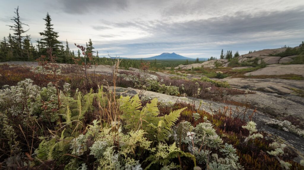
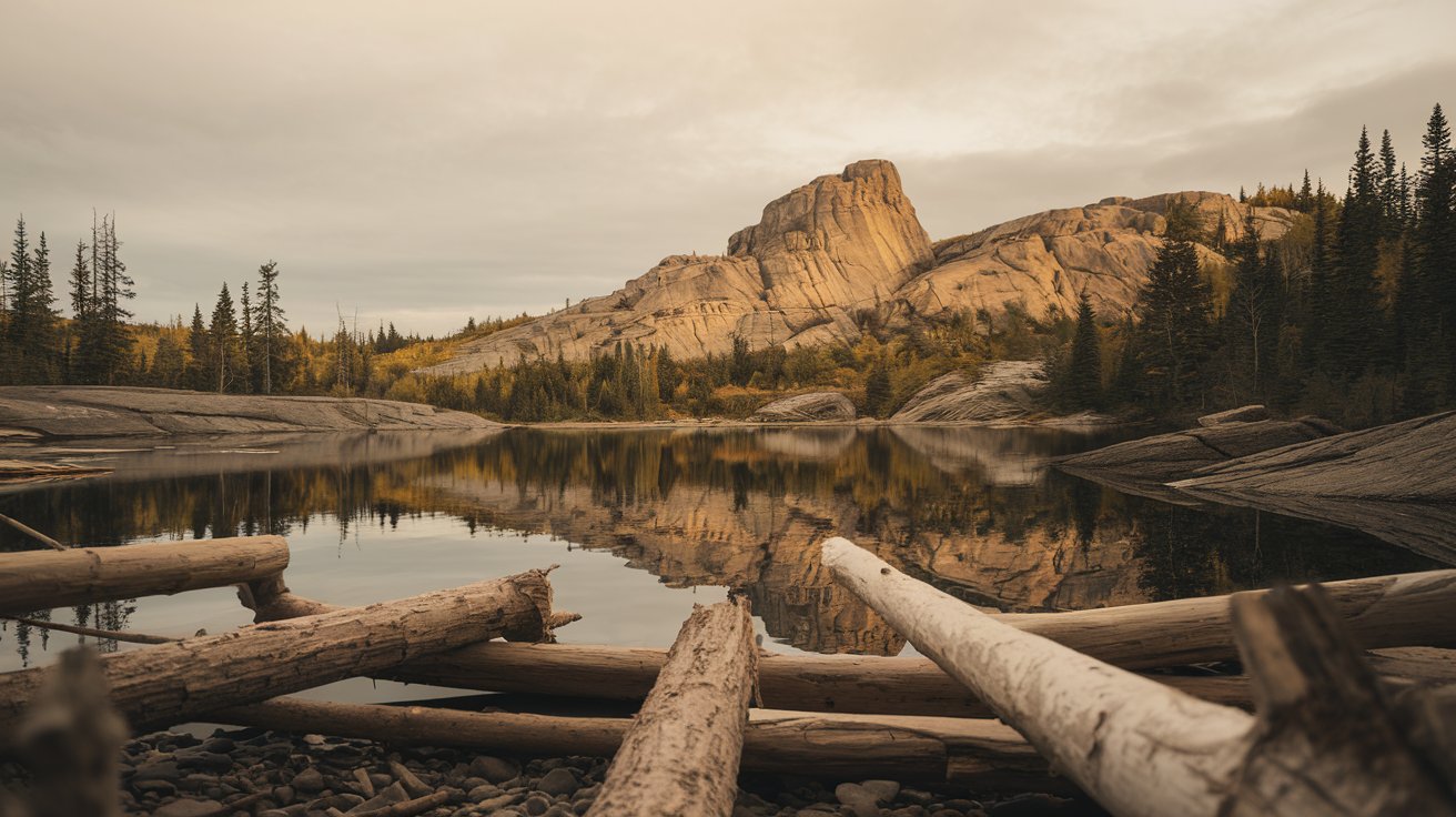
The Canadian Shield consists primarily of igneous and metamorphic rocks, including granite, gneiss, and volcanic formations. These rocks were once deep beneath ancient mountains that have long since eroded away. The exposed bedrock creates a distinctive landscape characterized by rocky outcrops, thousands of lakes, boreal forests, and minimal soil cover. This unique terrain extends into the United States, reaching northern Minnesota, Wisconsin, Michigan, and New York, making it a shared geological heritage between the two nations.
How Old Is the Canadian Shield
The Canadian Shield contains some of the oldest rocks on Earth, with formations dating back approximately 4.28 billion years. The Acasta Gneiss in the Northwest Territories holds the record as one of the planet’s oldest known rock formations, discovered in 1989 and precisely dated using advanced radiometric techniques. Most of the Shield’s rocks range between 2.5 and 4 billion years old, formed during the Archean and Proterozoic eons when Earth’s crust was still developing and stabilizing.
This extraordinary age makes the Canadian Shield older than most continents and predates complex life on Earth. The rocks preserve evidence of ancient volcanic activity, meteor impacts, and the formation of Earth’s first stable continental crust. In 2026, researchers continue using these ancient rocks to understand early atmospheric conditions, the origin of life, and planetary formation processes. The Shield’s geological stability has allowed it to remain largely unchanged for billions of years, surviving multiple continental collisions and mountain-building events that have reshaped other parts of the globe.
Why Is It Called the Canadian Shield
The term Canadian Shield derives from its shape and protective function. When viewed on a map, this geological formation resembles a warrior’s shield centered on Hudson Bay, with its curved edges extending outward across Canada. The name was popularized in the late 19th century as geologists recognized this distinct rock formation as a unified geological feature. The shield metaphor also reflects how this ancient bedrock forms the stable foundation or core around which the rest of the North American continent developed.
Alternative names include the Laurentian Plateau and the Laurentian Shield, referencing the Laurentian Mountains in Quebec. Indigenous peoples have inhabited this region for over 10,000 years and maintain their own names for different areas within the Shield. The Canadian Shield designation became standardized in scientific literature during the early 20th century as geological surveys mapped its full extent. In 2026, while the name remains predominantly used in English-speaking contexts, geologists increasingly acknowledge the diverse cultural and linguistic heritage of this vast region.
How Was the Canadian Shield Formed
The Canadian Shield formed through billions of years of complex geological processes beginning in the Archean eon. Ancient volcanic activity created the initial igneous rocks, while intense heat and pressure transformed these into metamorphic formations. Multiple episodes of mountain building occurred as small protocontinents collided and fused together, creating the stable craton that exists today. These ancient mountains, once potentially as tall as the Himalayas, eroded over hundreds of millions of years, exposing the deep crustal rocks we see at the surface.
Glaciation played a crucial role in shaping the modern Canadian Shield landscape. During the Pleistocene epoch, massive ice sheets up to two miles thick repeatedly advanced and retreated across the region. These glaciers scraped away soil and loose rock, carved out lake basins, and deposited erratic boulders across the landscape. The most recent glacial retreat, ending approximately 10,000 years ago, created the distinctive terrain of bare rock, countless lakes, and thin soils that characterize the Shield today. In 2026, evidence of glacial activity remains visible throughout the region in the form of striations, eskers, and glacially polished rock surfaces.
Natural Resources in the Canadian Shield
The Canadian Shield contains some of the world’s richest mineral deposits, making it a cornerstone of Canada’s resource economy. The region produces significant quantities of gold, silver, copper, nickel, iron ore, uranium, and diamonds. In 2026, the Shield supplies approximately 60% of Canada’s mineral production, with major mining operations in Ontario, Quebec, Saskatchewan, and the Northwest Territories. The Sudbury Basin alone contains one of the world’s largest nickel deposits, while the Abitibi greenstone belt in Quebec and Ontario ranks among the planet’s most productive gold-mining regions.
Beyond minerals, the Canadian Shield provides abundant hydroelectric power, forestry resources, and freshwater reserves. The region’s numerous rivers and elevation changes create ideal conditions for hydroelectric generation, with facilities providing clean energy to millions of people across Canada and the northern United States. The boreal forest covering much of the Shield supports a substantial forestry industry, producing lumber and pulp. The Shield also contains an estimated 20% of the world’s freshwater in its countless lakes and rivers, making it invaluable for future water security as climate patterns shift globally through 2026 and beyond.
Canadian Shield Population and Human Settlement
The Canadian Shield has a relatively sparse population density due to its rocky terrain, harsh climate, and limited agricultural potential. As of 2026, approximately 10% of Canada’s population lives within the Shield region, concentrated primarily in southern areas near major cities like Sudbury, Thunder Bay, and Quebec City. The challenging landscape and short growing season have historically discouraged large-scale settlement, with most communities developing around mining operations, forestry centers, or hydroelectric facilities.
Indigenous communities have thrived in the Canadian Shield for millennia, developing sophisticated knowledge systems adapted to the environment. The Cree, Ojibwe, Innu, and many other First Nations maintain strong cultural connections to Shield territories in 2026, practicing traditional activities like hunting, fishing, and trapping alongside modern economic pursuits. European settlement began in earnest during the 17th century with the fur trade, followed by waves of mining and forestry development. Today, population centers within the Shield tend to be small, resource-dependent towns, though some areas near the southern edge have experienced growth as urbanization expands from cities like Toronto and Montreal.
10 Fascinating Facts About the Canadian Shield
Understanding the Canadian Shield requires examining specific characteristics that make this geological formation unique. These 10 facts highlight the Shield’s importance to North American geography, ecology, and human history.
Fact 1: Covers Nearly Half of Canada
The Canadian Shield encompasses approximately 8 million square kilometers, representing nearly 50% of Canada’s total land area. This massive rock formation extends from the Great Lakes northward to the Arctic Ocean, and from Alberta eastward to Labrador. The Shield also reaches into the United States, covering portions of northern Minnesota, Wisconsin, Michigan, and the Adirondack Mountains of New York. In 2026, this remains the largest exposed Precambrian shield area on Earth, providing researchers with unparalleled access to ancient geological formations that elsewhere remain buried beneath younger sedimentary layers.
Fact 2: Contains the World’s Oldest Rocks
Some rocks within the Canadian Shield date back 4.28 billion years, nearly as old as Earth itself. The Acasta Gneiss near Great Slave Lake in the Northwest Territories represents one of the oldest known crustal fragments on the planet. These ancient formations preserve evidence of Earth’s earliest continental crust and provide scientists with crucial information about conditions during the planet’s formative period. In 2026, advanced dating techniques continue to refine our understanding of these rocks, with some samples potentially pushing the age record even further back in time.
Fact 3: Shaped by Glacial Activity
The Canadian Shield’s current landscape resulted largely from repeated glaciation during the Pleistocene epoch. Massive ice sheets advanced and retreated across the region at least four times, with the most recent glacial period ending approximately 10,000 years ago. These glaciers carved out the Shield’s characteristic features including thousands of lakes, exposed bedrock, and thin soil cover. The weight of ice up to two miles thick actually depressed the Earth’s crust, and the land continues to rebound slowly in 2026, rising at rates of up to one centimeter per year in some areas.
Fact 4: Home to Millions of Lakes
The Canadian Shield contains an estimated 2 million lakes, more than any other geological region of comparable size on Earth. These water bodies range from small ponds to massive lakes like Great Bear Lake and Great Slave Lake, two of the world’s ten largest lakes. The abundance of lakes resulted from glacial scouring that created countless depressions in the bedrock, which filled with meltwater as the ice sheets retreated. In 2026, these lakes provide critical habitat for wildlife, support recreational activities, and contain approximately 20% of the world’s freshwater reserves, making the Shield increasingly important for global water security.
Fact 5: Rich in Valuable Minerals
The Canadian Shield ranks among the world’s most mineral-rich regions, producing substantial quantities of gold, nickel, copper, iron ore, uranium, and diamonds. The Sudbury Basin contains one of Earth’s largest nickel-copper-platinum deposits, formed by a meteorite impact 1.85 billion years ago. The Abitibi greenstone belt has produced over 200 million ounces of gold since mining began. In 2026, mineral production from the Shield contributes billions of dollars annually to Canadian and American economies, with new deposits continuing to be discovered using advanced exploration technologies including satellite imaging and artificial intelligence analysis.
Fact 6: Supports Vast Boreal Forests
Despite thin soils and harsh climate, the Canadian Shield supports extensive boreal forest ecosystems dominated by spruce, pine, and fir trees. This forest biome, also called taiga, represents one of Earth’s largest terrestrial ecosystems and plays a crucial role in global carbon cycling. The boreal forest covering the Shield stores an estimated 208 billion tons of carbon, making it vital for climate regulation. In 2026, these forests support diverse wildlife including moose, caribou, wolves, and black bears, while providing sustainable forestry resources and increasingly recognized ecosystem services that extend far beyond the region’s boundaries.
Fact 7: Geologically Stable for Billions of Years
The Canadian Shield represents a craton, an extremely stable portion of continental crust that has remained tectonically inactive for billions of years. Unlike regions near plate boundaries that experience frequent earthquakes and volcanic activity, the Shield has been geologically quiet since the Precambrian era. This stability has allowed ancient rocks to remain largely undisturbed, preserving geological records that would have been destroyed elsewhere. In 2026, scientists consider the Shield one of Earth’s most stable regions, with minimal earthquake risk and no volcanic activity, making it ideal for certain types of research facilities and long-term geological storage projects.
Fact 8: Provides Abundant Hydroelectric Power
The Canadian Shield’s numerous rivers and substantial elevation changes create exceptional conditions for hydroelectric power generation. Major facilities like the James Bay Project in Quebec and the Churchill Falls facility in Labrador harness the region’s water resources to produce clean, renewable electricity. In 2026, hydroelectric installations within the Shield generate over 100,000 megawatts of power, supplying energy to millions of people across Canada and exporting significant amounts to the northeastern United States. The Shield’s hydroelectric potential remains only partially developed, with additional projects under consideration to meet growing demand for renewable energy sources.
Fact 9: Poor Agricultural Land Despite Its Size
The Canadian Shield offers limited agricultural potential due to thin, acidic soils, abundant bedrock, short growing seasons, and cold climate. Glacial scouring removed most soil cover, leaving only shallow deposits insufficient for conventional farming. The rocky terrain and numerous lakes further reduce available agricultural land. In 2026, less than 1% of the Shield is used for agriculture, primarily in southern regions where soil conditions marginally support hay production and limited livestock grazing. This agricultural limitation has shaped settlement patterns, keeping population density low and preserving much of the region in a relatively natural state compared to more fertile areas of North America.
Fact 10: Critical Habitat for Wildlife
The Canadian Shield provides essential habitat for numerous species adapted to boreal ecosystems, including woodland caribou, moose, black bears, wolves, lynx, and wolverines. The region’s countless lakes support healthy populations of fish including walleye, northern pike, and lake trout. Migratory bird species rely on the Shield’s wetlands and forests, with an estimated 3 billion birds breeding in the boreal region annually. In 2026, conservation efforts focus on protecting large, intact wilderness areas within the Shield as climate change pushes species northward and industrial development expands. The Shield’s vast size and relatively low human density make it crucial for maintaining biodiversity in an increasingly developed world.
Animals of the Canadian Shield
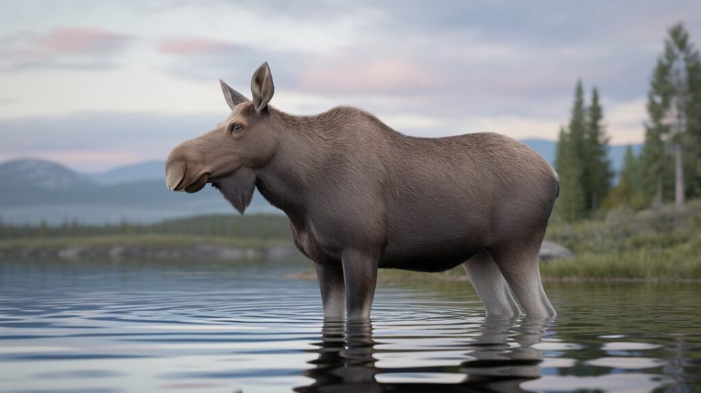
The Canadian Shield supports diverse wildlife adapted to harsh winters, short summers, and extensive forest-lake ecosystems. Large mammals include moose, the largest member of the deer family, which thrive in the Shield’s wetlands and forests. Woodland caribou depend on old-growth boreal forests, while black bears are common throughout the region. Predators like gray wolves, lynx, wolverines, and foxes maintain ecological balance in these wilderness areas.
Smaller mammals such as beavers, snowshoe hares, porcupines, and martens play important roles in Shield ecosystems. The region’s abundant lakes support healthy fish populations including walleye, northern pike, lake trout, and whitefish. Bird diversity is remarkable, with species ranging from common loons and bald eagles to numerous warblers, finches, and waterfowl. In 2026, wildlife populations face pressures from climate change, industrial development, and habitat fragmentation, making conservation of large, connected wilderness areas within the Shield increasingly important for long-term species survival.
Canadian Shield Climate and Weather Patterns
The Canadian Shield experiences a continental subarctic climate characterized by long, cold winters and short, warm summers. Winter temperatures frequently drop below -40°F in northern areas, while southern regions typically range from 0°F to 20°F. Summer temperatures average between 55°F and 70°F, with occasional heat waves pushing temperatures higher. The region receives moderate precipitation, typically 15 to 40 inches annually, with significant variation between areas. Snowfall is substantial, with northern regions receiving over 100 inches annually, while southern areas average 60 to 80 inches.
In 2026, climate change is measurably affecting the Canadian Shield, with temperatures rising faster than the global average, particularly in winter months. The growing season has extended by 10 to 14 days since the 1950s, and precipitation patterns are shifting, with more falling as rain rather than snow. These changes impact forest composition, permafrost stability in northern areas, lake ice duration, and wildlife populations. Weather patterns show increased variability, with more frequent extreme events including heat waves, droughts, and intense rainfall. Scientists closely monitor these trends as the Shield’s vast forests and water resources play crucial roles in regional and global climate regulation.
Economic Importance of the Canadian Shield in 2026
The Canadian Shield remains economically vital in 2026, contributing significantly to Canada’s GDP through mining, forestry, hydroelectric power, and tourism. The mining sector alone generates over $50 billion annually from operations extracting gold, nickel, copper, diamonds, and other minerals. Major companies operate hundreds of active mines across the Shield, employing tens of thousands of workers directly and supporting many more jobs in related industries. Technological advances in mineral exploration continue to identify new deposits, ensuring the region’s mining industry remains robust for decades to come.
Forestry operations across the Canadian Shield produce lumber, pulp, and paper products valued at billions of dollars annually, though the industry faces ongoing challenges from international competition and environmental concerns. Hydroelectric facilities provide clean, renewable energy worth billions in revenue while reducing carbon emissions compared to fossil fuel alternatives. Tourism has grown substantially, with the Shield’s wilderness attracting hunters, anglers, canoeists, and nature enthusiasts who contribute hundreds of millions to local economies. In 2026, economic development increasingly balances resource extraction with environmental protection and Indigenous rights, as stakeholders recognize the need for sustainable approaches that preserve the Shield’s ecological integrity while supporting economic prosperity.
Related video about 10 facts about the canadian shield
This video complements the article information with a practical visual demonstration.
Everything you need to know about 10 facts about the canadian shield
What are 10 interesting facts about the Canadian Shield?
The Canadian Shield covers nearly half of Canada with 8 million square kilometers of ancient rock. It contains Earth’s oldest rocks at 4.28 billion years, was shaped by massive glaciers, and holds approximately 2 million lakes. The region is rich in minerals like gold and nickel, supports vast boreal forests, and has remained geologically stable for billions of years. It provides abundant hydroelectric power, offers poor agricultural land due to thin soils, and serves as critical wildlife habitat. The Shield also extends into the northern United States, making it a shared geological heritage.
How was the Canadian Shield formed?
The Canadian Shield formed over billions of years through ancient volcanic activity, mountain building, and erosion. Initial igneous rocks formed during the Archean eon were transformed by heat and pressure into metamorphic formations. Multiple protocontinents collided and fused together, creating massive mountain ranges that subsequently eroded over hundreds of millions of years, exposing deep crustal rocks. Glaciation during the Pleistocene epoch carved the modern landscape, with ice sheets up to two miles thick scraping away soil and creating the characteristic bare rock, lakes, and thin soil cover visible today in 2026.
Why is it called the Canadian Shield?
The term Canadian Shield comes from the formation’s shield-like shape when viewed on a map, centered on Hudson Bay with curved edges extending outward. The name reflects both this visual appearance and the geological concept of a shield as the stable, protective core of a continent. Geologists popularized this designation in the late 19th century, though alternative names include Laurentian Plateau and Laurentian Shield. The name became standardized in scientific literature during the early 20th century and remains the most widely recognized term in 2026, despite various Indigenous names for different regions within this vast geological formation.
What natural resources are found in the Canadian Shield?
The Canadian Shield contains world-class deposits of gold, silver, copper, nickel, iron ore, uranium, and diamonds, supplying approximately 60% of Canada’s mineral production in 2026. The Sudbury Basin holds one of Earth’s largest nickel deposits, while the Abitibi greenstone belt ranks among the world’s most productive gold regions. Beyond minerals, the Shield provides abundant hydroelectric power from numerous rivers, forestry resources from extensive boreal forests, and approximately 20% of the world’s freshwater in its countless lakes. These resources make the Shield economically vital to both Canada and portions of the northern United States.
How old is the Canadian Shield?
The Canadian Shield contains rocks dating back approximately 4.28 billion years, making it one of Earth’s oldest geological formations. The Acasta Gneiss in the Northwest Territories represents one of the planet’s oldest known rock formations, while most Shield rocks range between 2.5 and 4 billion years old. These rocks formed during the Archean and Proterozoic eons when Earth’s crust was developing. In 2026, researchers continue studying these ancient formations to understand early Earth conditions, atmospheric development, and the origins of continental crust, as the Shield preserves geological records unavailable in younger rock formations elsewhere.
What animals live in the Canadian Shield?
The Canadian Shield supports diverse wildlife adapted to boreal ecosystems, including large mammals like moose, woodland caribou, black bears, gray wolves, lynx, and wolverines. Smaller mammals such as beavers, snowshoe hares, and martens thrive throughout the region. The Shield’s abundant lakes contain healthy populations of walleye, northern pike, lake trout, and whitefish. Bird diversity includes common loons, bald eagles, numerous warblers, and waterfowl species, with an estimated 3 billion birds breeding annually in the boreal region. In 2026, conservation efforts focus on protecting large wilderness areas as climate change and industrial development impact traditional wildlife habitat.
| Key Aspect | Important Details | Significance |
|---|---|---|
| Age | 4.28 billion years old rocks, Precambrian formation | Oldest exposed crust on Earth, preserves early geological history |
| Size | 8 million square kilometers, nearly 50% of Canada | Largest exposed Precambrian shield globally |
| Natural Resources | Gold, nickel, copper, diamonds, hydroelectric power | 60% of Canada’s mineral production in 2026 |
| Water Resources | 2 million lakes, 20% of world’s freshwater | Critical for global water security and hydroelectric generation |
| Ecology | Vast boreal forests, diverse wildlife habitat | Stores 208 billion tons of carbon, vital for climate regulation |
| Geological Stability | Inactive craton, minimal seismic activity | One of Earth’s most stable regions for research and development |