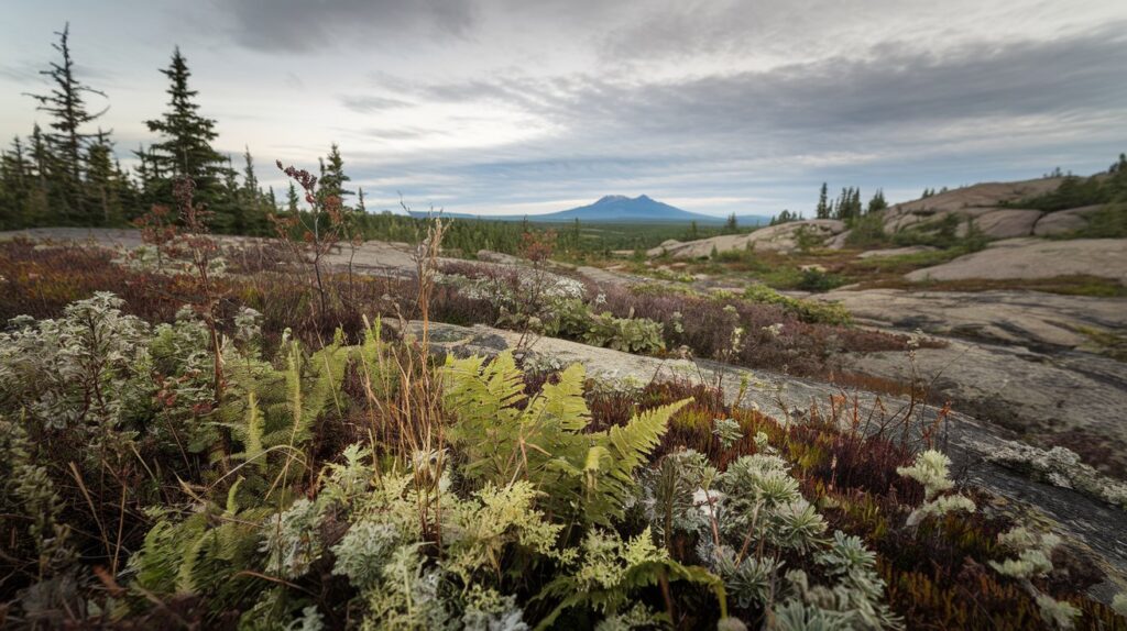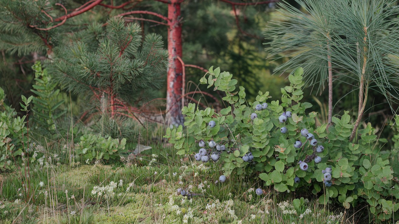
The Canadian Shield vegetation consists primarily of vast boreal forests dominated by coniferous trees, including black spruce, jack pine, and white spruce. This ancient geological formation, covering nearly 2 million square miles across Canada, supports diverse plant life adapted to harsh climates, rocky terrain, and short growing seasons. Understanding the vegetation in the Canadian Shield reveals how plants thrive in one of North America’s most challenging environments, where thin soils and extreme temperatures shape every living organism.
Understanding the Canadian Shield Geography and Climate
The Canadian Shield, also known as the Laurentian Plateau, represents one of the oldest geological formations on Earth, dating back approximately 4 billion years. This massive rock formation extends across Ontario, Quebec, Manitoba, Saskatchewan, Nunavut, Northwest Territories, and parts of Minnesota, Wisconsin, Michigan, and New York in the United States. The shield’s exposed bedrock, scraped clean by ancient glaciers during the last ice age, creates a distinctive landscape of thin soils, countless lakes, and rugged terrain that fundamentally shapes what vegetation can survive here.
The climate of the Canadian Shield features long, harsh winters with temperatures dropping below -40°F and short, mild summers averaging 60-70°F. This subarctic climate zone receives 15-20 inches of precipitation annually, with most falling as snow. The growing season lasts only 60-120 days depending on latitude, forcing plants to adapt remarkable survival strategies. These extreme conditions, combined with acidic soils and exposed granite bedrock, create a unique ecosystem where only the hardiest vegetation can flourish and reproduce successfully.
Dominant Tree Species in the Canadian Shield
The boreal forest ecosystem defines the Canadian Shield landscape, with coniferous trees comprising 80-90% of forest coverage as of 2026. These evergreen species have evolved specific adaptations to survive freezing temperatures, poor soils, and limited sunlight during winter months. The needle-shaped leaves reduce water loss, dark coloration maximizes heat absorption, and conical shapes shed heavy snow loads efficiently.
Black Spruce: The Shield’s Most Common Tree
Black spruce (Picea mariana) dominates approximately 40% of forested areas throughout the Canadian Shield, thriving in poorly drained wetlands and bog environments. This resilient conifer grows slowly, reaching heights of 30-50 feet over 100-150 years, with some specimens living 300+ years. Black spruce features short, blue-green needles and small cones that remain closed for years until forest fires trigger seed release. The species’ shallow root system allows it to anchor in thin soils above bedrock, while its tolerance for acidic, waterlogged conditions makes it the dominant tree in northern peatlands.
Jack Pine and White Spruce Forests
Jack pine (Pinus banksiana) covers approximately 25% of Canadian Shield forests, particularly in drier, sandy soils with better drainage. This fire-adapted species uses serotinous cones that require heat above 120°F to release seeds, making it perfectly suited to the region’s natural fire cycle of 50-150 years. Jack pines grow 40-70 feet tall with twisted branches and pairs of short, stiff needles. White spruce (Picea glauca) represents another 20% of forest coverage, preferring well-drained upland sites and river valleys. White spruce reaches 80-100 feet in optimal conditions, featuring aromatic needles and larger cones than black spruce, providing crucial habitat for wildlife and commercial timber resources valued at over $2 billion annually in 2026.
What Vegetation Types Define the Canadian Shield
Beyond the dominant coniferous forests, the Canadian Shield supports diverse vegetation zones ranging from dense woodlands to exposed tundra. These ecological communities form distinct patterns based on latitude, elevation, soil depth, and moisture availability, creating a mosaic of habitats across the shield’s vast expanse.
Boreal Forest Characteristics
The boreal forest biome encompasses approximately 1.2 million square miles of the Canadian Shield, making it one of Earth’s largest terrestrial ecosystems. This northern forest zone features closed-canopy forests with 60-80% tree coverage, thick moss carpets, and understory vegetation adapted to low light conditions. Balsam fir, white birch, and trembling aspen create mixed stands alongside dominant conifers, while the forest floor supports lichens, mosses, ferns, and berry-producing shrubs. The boreal ecosystem sequesters an estimated 208 billion tons of carbon, playing a critical role in global climate regulation and representing invaluable ecological services worth trillions of dollars in 2026 environmental assessments.
Taiga and Forest-Tundra Transition Zones
The northern reaches of the Canadian Shield transition into taiga and forest-tundra ecotones where trees become increasingly stunted and sparse. This subarctic woodland features widely spaced black spruce and tamarack growing 10-20 feet tall, interspersed with tundra vegetation including dwarf shrubs, sedges, and extensive lichen mats. The transition zone shifts approximately 50-100 miles northward per degree Celsius of warming, with 2026 climate data showing significant changes in vegetation boundaries compared to historical records. These fragile ecosystems support caribou herds, provide critical breeding habitat for migratory birds, and demonstrate visible impacts of climate change on plant community composition and distribution patterns.
Understory Plants and Ground Vegetation
The forest understory in the Canadian Shield creates complex layers of vegetation beneath the tree canopy, with each stratum adapted to specific light, moisture, and nutrient conditions. These ground-level plants include shrubs, herbs, mosses, and lichens that form the foundation of forest food webs and provide essential ecosystem services including soil stabilization, nutrient cycling, and wildlife habitat.
Berry-Producing Shrubs and Food Sources
Blueberries (Vaccinium species), cranberries, and bearberries represent the most abundant fruiting shrubs throughout Canadian Shield forests, covering approximately 30-40% of forest floor area in suitable habitats. These low-growing woody plants, typically 6-24 inches tall, produce nutrient-rich berries that sustain black bears, birds, small mammals, and indigenous communities who have harvested these traditional foods for thousands of years. Labrador tea (Rhododendron groenlandicum) thrives in acidic bog environments, featuring leathery evergreen leaves used medicinally and ceremonially. Commercial wild blueberry harvests from the Canadian Shield generate over $150 million annually in 2026, supporting rural economies while maintaining ecosystem health through sustainable harvest practices.
Mosses, Lichens, and Forest Floor Coverage
Sphagnum mosses dominate wetland areas, forming thick mats that can hold 20 times their dry weight in water and create acidic conditions that preserve organic matter for centuries. These peat-forming plants cover approximately 350,000 square miles of Canadian Shield wetlands, accumulating carbon at rates of 20-30 grams per square meter annually. Reindeer lichens (Cladonia species) carpet dry, well-drained sites, providing crucial winter forage for caribou herds and creating distinctive silver-gray ground cover. Feather mosses including Pleurozium schreberi form deep cushions beneath spruce forests, retaining moisture, insulating soils, and supporting diverse invertebrate communities. The combined cryptogamic layer of mosses, lichens, and liverworts contributes significantly to forest biodiversity, hosting thousands of microscopic organisms per square inch of forest floor.
Wetland and Aquatic Vegetation in the Canadian Shield
The Canadian Shield contains approximately 1.5 million lakes and countless wetland ecosystems that support specialized aquatic and semi-aquatic vegetation. These water-dependent plant communities range from floating aquatics to emergent marsh plants, creating productive habitats that support fish, waterfowl, and numerous other wildlife species throughout the region.
Bog and Muskeg Plant Communities
Bogs and muskegs cover approximately 15-20% of the Canadian Shield landscape, representing nutrient-poor wetlands dominated by sphagnum mosses, sedges, and specialized shrubs. These peatland ecosystems accumulate partially decomposed organic matter in layers up to 30 feet deep, storing massive amounts of carbon while providing habitat for unique plant species. Pitcher plants (Sarracenia purpurea), sundews, and other carnivorous plants supplement nutrient-poor conditions by capturing insects. Tamarack (Larix laricina), a deciduous conifer, forms open stands in these waterlogged environments, while leatherleaf, bog rosemary, and cotton grass create distinctive vegetation assemblages found nowhere else in North America.
Lake and Stream Margin Vegetation
Emergent aquatic plants colonize shallow lake margins and stream edges throughout the Canadian Shield, with cattails, bulrushes, and water lilies dominating sheltered bays and slow-moving waters. Wild rice (Zizania palustris) grows in shallow, nutrient-rich lakes, providing critical food for waterfowl and traditional harvests for indigenous communities generating over $25 million in annual commerce as of 2026. Submerged aquatics including pondweeds, water milfoils, and bladderworts create underwater forests that oxygenate water, stabilize sediments, and provide spawning habitat for fish populations. The riparian vegetation zones surrounding water bodies feature willows, alders, and red osier dogwood that prevent erosion, filter runoff, and create transitional habitats between aquatic and terrestrial ecosystems.
What Crops Grow in the Canadian Shield
The agricultural potential of the Canadian Shield remains extremely limited due to thin, acidic soils, short growing seasons, and extensive bedrock exposure. However, several specialized farming operations exist in southern portions of the shield where glacial deposits created deeper soil layers and more favorable growing conditions for hardy crop varieties and livestock operations.
Hay and forage crops represent the primary agricultural products from Canadian Shield regions, with timothy grass, clover, and alfalfa grown in river valleys and areas with adequate soil depth. Small-scale potato cultivation occurs in New Brunswick and Quebec portions of the shield, where sandy soils and cool temperatures produce high-quality tubers. Blueberry farms have expanded significantly, with commercial operations managing approximately 100,000 acres of wild and cultivated blueberries generating over $300 million annually by 2026. Greenhouse operations in Thunder Bay, Sudbury, and other shield communities produce tomatoes, cucumbers, and leafy greens using hydroponics and controlled environments, bypassing soil limitations entirely. Beef cattle ranching occurs in southern shield regions where cleared land supports pastures and hay production, though operations remain small-scale compared to prairie provinces.
Vegetation Adaptations to Canadian Shield Conditions
Plants surviving in the Canadian Shield have evolved remarkable physiological adaptations that enable them to thrive despite extreme cold, nutrient-poor soils, frequent fires, and intense environmental stresses. These survival mechanisms represent millions of years of natural selection, creating species perfectly matched to one of Earth’s harshest growing environments.
Cold tolerance strategies include antifreeze compounds in cell tissues, dormancy mechanisms triggered by day length rather than temperature, and evergreen foliage that enables photosynthesis whenever conditions permit. Nutrient acquisition adaptations feature mycorrhizal associations with soil fungi that extend effective root systems hundreds of times, enabling access to scarce minerals locked in rock and organic matter. Many species produce extensive underground root systems that store carbohydrates and survive above-ground destruction by fire or browsing. Fire-adapted characteristics include serotinous cones releasing seeds after fires, rapid post-fire regeneration from root systems, and bark thickness that protects cambium layers from heat damage. The shallow root systems of many shield plants spread horizontally rather than vertically, anchoring in thin soil layers while accessing moisture and nutrients across wide areas of forest floor.
Canadian Shield Vegetation Facts for Kids
The Canadian Shield forests contain fascinating plants that have survived for thousands of years in some of North America’s coldest and oldest landscapes. These incredible ecosystems showcase how nature adapts to challenging environments, creating homes for countless animals while providing essential resources for people living in and around the shield region.
Ten amazing facts about Canadian Shield vegetation include: trees growing incredibly slowly, with some adding less than one inch in diameter per decade; lichens that can live over 1,000 years on exposed rock surfaces; carnivorous plants that trap and digest insects for nutrients; berries that can survive freezing solid and thaw without damage; trees with cones that only open during forest fires; mosses that absorb 20 times their weight in water; plants that stay green all winter under the snow; roots that grow sideways because the soil is too thin to go deep; flowers that bloom within days of snow melting to take advantage of short summers; and forests that provide homes for wolves, moose, bears, and millions of birds. The boreal forest produces so much oxygen that scientists call it one of Earth’s lungs, cleaning our air while storing carbon that might otherwise contribute to climate change. Kids visiting the Canadian Shield can observe these remarkable plants in national parks including Voyageurs National Park in Minnesota, which contains over 200,000 acres of shield landscape accessible to American visitors.
Natural Resources and Vegetation Relationships
The natural resources of the Canadian Shield maintain complex relationships with vegetation patterns, as mining, forestry, and hydroelectric development interact with plant communities across millions of acres. These resource extraction activities generate over $80 billion annually in economic value as of 2026, while simultaneously impacting the ecosystems that define the shield’s ecological character and support its biodiversity.
Forestry operations harvest approximately 250 million cubic meters of timber annually from Canadian Shield forests, with sustainable management practices increasingly emphasizing ecosystem-based approaches that maintain forest structure, composition, and function. Mining activities for gold, copper, nickel, iron, and other minerals disturb vegetation directly at extraction sites while creating indirect impacts through roads, power lines, and community development. Successful reclamation projects have restored over 500,000 acres of disturbed lands since 2000, using native vegetation species and natural regeneration processes to rebuild functional ecosystems. Hydroelectric reservoirs have flooded extensive forest areas, creating new aquatic habitats while eliminating terrestrial vegetation and altering downstream ecosystems through flow regulation. The economic value of intact shield vegetation for ecosystem services including carbon storage, water filtration, wildlife habitat, and recreation exceeds $500 billion annually according to 2026 environmental accounting estimates.
Climate Change Impacts on Shield Vegetation
Climate change effects on Canadian Shield vegetation have accelerated dramatically since 2000, with average temperatures increasing 2.5-3.5°F across the region and precipitation patterns becoming more variable and intense. These environmental shifts alter competitive relationships among plant species, modify disturbance regimes including fire and insect outbreaks, and enable range expansions of southern species into historically cooler shield environments.
Forest composition changes documented through 2026 monitoring programs show deciduous species including aspen and birch expanding at the expense of black spruce in warmer, drier sites. Permafrost thaw in northern shield regions transforms forest structure as frozen ground melts, causing trees to tilt, creating drunken forests, and converting woodlands to wetlands or grasslands. Insect outbreak intensification, particularly spruce budworm and bark beetles, has increased mortality rates 300-400% since 2000, with warmer winters enabling pest survival and longer summers extending reproductive periods. Fire frequency and severity have increased 35% across the shield, with larger, hotter fires creating different regeneration patterns and potentially converting forests to shrublands in extremely disturbed areas. Phenological shifts in leaf emergence, flowering, and senescence affect pollinator relationships, herbivore food availability, and competitive interactions among plant species, potentially destabilizing ecological relationships that evolved over millennia.
Conservation and Protection of Shield Vegetation
Protected areas encompassing Canadian Shield vegetation have expanded to approximately 180 million acres by 2026, including national parks, provincial parks, and indigenous-managed conservation lands. These conservation initiatives preserve representative examples of shield ecosystems while maintaining ecological processes, protecting rare species, and safeguarding areas of cultural significance to First Nations and indigenous communities.
Notable protected landscapes include Pukaskwa National Park in Ontario, protecting 725 square miles of pristine shield wilderness; Quetico Provincial Park’s 1.2 million acres of canoe country; and extensive boreal forest reserves in Quebec and Manitoba. Indigenous Protected and Conserved Areas represent a growing conservation model, with First Nations communities establishing over 50 million acres of protected lands managed according to traditional knowledge and contemporary conservation science. Sustainable forestry certification programs cover approximately 350 million acres of commercially managed shield forests, implementing practices that maintain biodiversity, protect water quality, and ensure long-term forest productivity. Research and monitoring programs operated by universities, government agencies, and non-profit organizations track vegetation changes, assess climate impacts, and develop adaptive management strategies to maintain shield ecosystem health amid accelerating environmental change.
Related video about what is the vegetation in the canadian shield
This video complements the article information with a practical visual demonstration.
What you should know
What is the vegetation in the Canadian Shield for kids?
The Canadian Shield vegetation consists mainly of tough evergreen trees like spruce and pine that keep their needles all year long. The forest floor has soft mosses, colorful lichens, and berry bushes including blueberries and cranberries that animals love to eat. These plants survive extremely cold winters by staying dormant under snow and growing quickly during short summers. The shield also has carnivorous plants like pitcher plants that eat insects, and special trees with cones that only open during forest fires to release their seeds. Kids can see these amazing plants in national parks and wilderness areas throughout the shield region.
What kind of vegetation does Canada have in the Shield region?
Canada’s Shield region features boreal forest vegetation dominated by coniferous trees including black spruce, jack pine, white spruce, balsam fir, and tamarack. The understory contains shrubs like blueberries, Labrador tea, and leatherleaf, while the forest floor supports extensive moss and lichen communities. Wetland areas feature specialized bog vegetation including sphagnum mosses, sedges, and carnivorous plants. Northern portions transition to forest-tundra with stunted trees and tundra vegetation. The region’s 1.5 million lakes support aquatic plants including water lilies, wild rice, and various submerged species. This diverse vegetation reflects adaptations to thin soils, extreme cold, short growing seasons, and the shield’s ancient bedrock foundation.
What crops grow in the Canadian Shield?
The Canadian Shield supports limited agricultural crops due to thin, acidic soils and harsh climate conditions. Primary crops include hay and forage grasses in river valleys with adequate soil depth. Wild and cultivated blueberries represent the most successful commercial crop, generating over $300 million annually from approximately 100,000 acres by 2026. Small-scale potato farming occurs in southern shield regions with suitable soils. Greenhouse operations produce tomatoes, cucumbers, and leafy greens using hydroponic systems. Beef cattle ranching exists where cleared land supports pastures. Traditional indigenous harvests include wild rice in shallow lakes and various medicinal plants, though these represent gathering rather than cultivation of crops.
How does the Canadian Shield climate affect vegetation?
Climate conditions fundamentally shape Canadian Shield vegetation through multiple limiting factors. Long winters with temperatures below -40°F restrict growing seasons to 60-120 days, forcing plants to complete life cycles rapidly. Annual precipitation of 15-20 inches, mostly as snow, limits available moisture during growing seasons. The subarctic climate favors evergreen conifers that photosynthesize whenever conditions permit rather than deciduous species requiring longer growing seasons. Extreme temperature fluctuations select for hardy species with antifreeze compounds and dormancy mechanisms. Thin soils resulting from glacial scouring contain limited nutrients, favoring slow-growing species efficient at nutrient acquisition. These climate factors create the distinctive boreal forest ecosystem with specialized adaptations found throughout the shield region.
What are the most important Canadian Shield landmarks?
Canadian Shield landmarks showcase the region’s geological and ecological significance. Major features include Lake Superior, the world’s largest freshwater lake by surface area; the Sudbury Basin, a 40-mile-wide impact crater containing rich mineral deposits; Niagara Escarpment, extending 450 miles through Ontario; and countless exposed bedrock formations revealing Earth’s ancient history. Ecological landmarks include vast boreal forests covering over 1.2 million square miles, extensive peatland complexes storing billions of tons of carbon, and the boreal-tundra transition zone demonstrating climate-driven vegetation changes. Protected areas like Pukaskwa National Park and Quetico Provincial Park preserve representative shield landscapes. These landmarks demonstrate the shield’s importance for geology, ecology, and natural resource wealth valued at hundreds of billions of dollars annually.
How was the Canadian Shield formed and how does this affect vegetation?
The Canadian Shield formed approximately 4 billion years ago through volcanic activity, mountain building, and subsequent erosion that exposed ancient metamorphic and igneous bedrock. Glacial activity during the last ice age, ending 10,000 years ago, scraped away most soil cover, creating thin, discontinuous soil deposits over exposed granite and gneiss. This geological history profoundly affects vegetation by limiting root penetration, creating nutrient-poor growing conditions, and producing countless lakes in glacially carved depressions. The shield’s ancient rocks contain limited nutrients compared to younger sedimentary regions, restricting agricultural potential while favoring slow-growing forest species adapted to infertile soils. Glacial deposits in valleys create localized areas with deeper soils supporting more diverse vegetation, creating a mosaic pattern across the landscape.
| Vegetation Type | Key Characteristics | Ecological Importance |
|---|---|---|
| Boreal Coniferous Forest | Black spruce, jack pine, white spruce covering 1.2 million square miles | Carbon storage of 208 billion tons, oxygen production, wildlife habitat |
| Wetland Vegetation | Sphagnum mosses, sedges, tamarack in 350,000 square miles of peatlands | Water filtration, carbon sequestration, specialized habitat for rare species |
| Understory Plants | Blueberries, lichens, mosses covering 30-40% of forest floor | Wildlife food sources, soil stabilization, nutrient cycling |
| Aquatic Vegetation | Water lilies, wild rice, submerged plants in 1.5 million lakes | Fish habitat, waterfowl food, water quality maintenance |
| Forest-Tundra Transition | Stunted spruce, dwarf shrubs, extensive lichen mats in northern zones | Caribou habitat, climate change indicator, biodiversity hotspot |